


Secret Land of the Southern Xinjiang | Laughter and Joy on the Pamir Plateau
If traveling is a kind of poison, I must have become hopelessly addicted to it, I guess. My friends all say that I'm either on the journey of traveling or preparing for one. I think the so-called antidote is on the journey itself! Along the way, I have witnessed various local customs and cultures, appreciated the grandeur of mountains and rivers, and made friends with a group of interesting people. Among them, there are joys, disappointments, encounters, and partings. When I look back on the past years later, some might have become blurry memory fragments, while some are still deeply engraved in my mind.

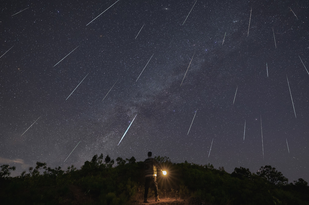
My initial impression of Xinjiang was during my summer vacation in my junior year of college in 2016. I traveled alone, carrying a backpack, staying in a youth hostel, and spent a month exploring Xinjiang. I walked around, took buses, and now, looking back, it can be regarded as a unique life experience. By chance, I heard that the apricot blossoms were in full bloom in southern Xinjiang. It felt as if I was in a secluded paradise. This brought back memories of Xinjiang and reminded me of its local customs. My desire to travel intensified once again. So, when the flowering season arrived, I came back. Coincidentally, when I was chatting with Tony earlier, I also mentioned that I had planned to visit Xinjiang. Tony was someone I met in Inner Mongolia last year. He is also a photography expert who led me into the world of star photography. Since then, I have been hooked and later went on a trip with him to capture the Orion meteor shower together.
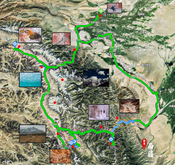
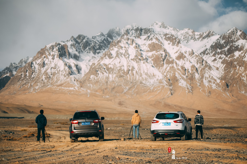
After the destination was chosen, it was time to plan the route. It was early February at that time. After discussing, the two of us decided to drive ourselves because Xinjiang is so vast. Although our goal this time was only the southern part of Xinjiang, the distance between scenic spots was often several hundred kilometers. Public transportation was immediately ruled out. Compared to chartering a car, driving by oneself seemed more flexible. One could arrange the time as one wished. It turned out that choosing to drive was the right decision. For a travel focused on photography like ours, having a car is simply too great. The light and shadow during sunrise and sunset are always what photographers prefer to pursue. And the sunsets in Xinjiang are around 9-10 o'clock. If you want to see the sunrise, you have to set off before dawn. If we chartered a car, the driver would probably think we were a bit troublesome!
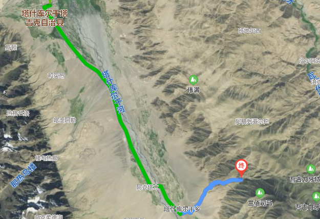
Overall, the self-driving route in Xinjiang is quite accessible. The route we decided on starts from Kashgar and heads south, passing through the relatively lesser-known Red Canyon and Muji Volcano. There is also a well-known Baisha Lake (we were fortunate enough to see it partially frozen). Further south is Gongere Peak and Muztag Peak (unfortunately, Muztag Peak was always shrouded in clouds and we couldn't see it in its true form). After reaching Taixian County, it heads east (Panlong Ancient Road, Wachacha Township, Xinghua Village, Tashag Road). Finally, it returns to Kashgar via Shache via G3012. This is a large loop route that covers most of the scenery and culture of the southern Xinjiang region. It truly deserves my praise for arranging such an excellent route!
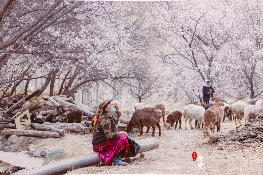
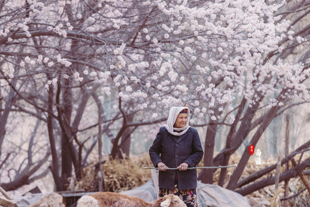
Xinghua Village - The Herding Old Man
Xinghua Village - An Interchange Across Time and Space
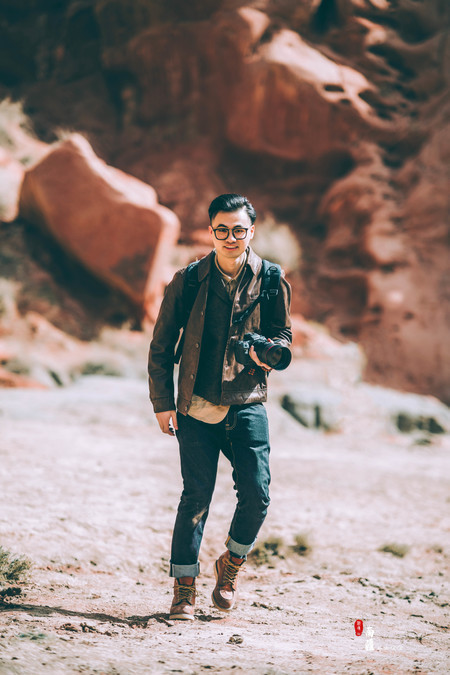
Kashi - That Touch of Innocence

奥依塔克冰川下的红峡谷
Mujie Volcano Crater - The Color of the Earth
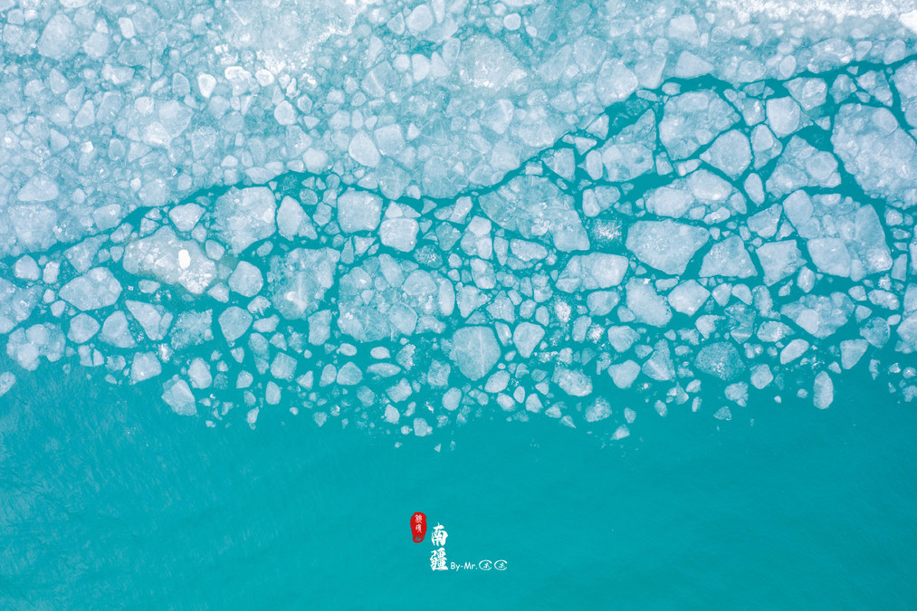
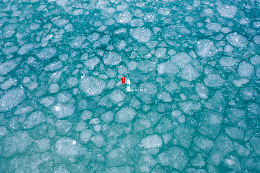
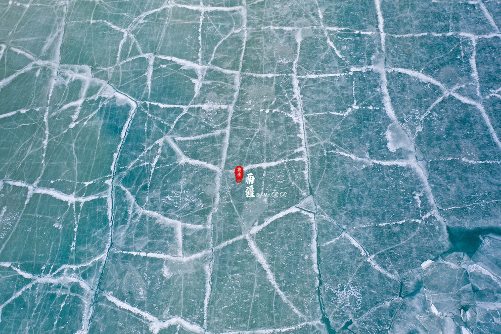
White Sand Lake - A Century in the Ice River
Panlong Ancient Road - No idea how many turns it has gone through
Tashagudao - Xuanzang's Route
Equipment: EOS R5
ef 24-70 f2.8, ef 70-200 f2.8, ef 85 f1.4 DJI Mavic 2 Pro
------------------------------------------------------
For this trip, you need to obtain border control permits for both Taya County and Muji Township. Taya County is in the Kashgar Region, while Muji Township is in the Kuchat Region. Therefore, they need to be processed separately. The border control permit for Taya County can be processed directly in Kashgar at the Kashgar International Car and RV Campground (one kilometer north of the North Expressway Toll Station in Kashgar).
The border control certificate for Muji Township needs to be processed in Atushi. The processing location is: Atushi Administrative Service Center. When applying for the border control certificate, it is recommended to bring a copy of your ID card. Atushi needs to bring the copy itself.
Also, please be aware of the processing hours: from 10:00 to 14:00 and from 16:00 to 19:00 on weekdays.
Kashi - That place full of exotic charm and childlike innocence
Kashi, also known as "Kashi Gher", means "the place where jade is abundant". Its recorded history dates back over 2,000 years. The territory of the Kashi region was home to the countries of Shule, Shaxi, Weitu, Zihuo, Xini, Pu Li, Yinei, Wuhejiao, Zhanwu, and Xiucong during the Qin and Han dynasties. Among them, Shule and Shaxi were larger. During Zhang Qian's mission to the Western Regions, he visited this place.
Kashi, as a key transportation hub along the ancient Silk Road, was a bustling international trading port where merchants from both China and foreign countries gathered. It is also the only national historical and cultural city in Xinjiang, embodying the unique customs, culture, architectural style and traditional economy of the Uyghur people.
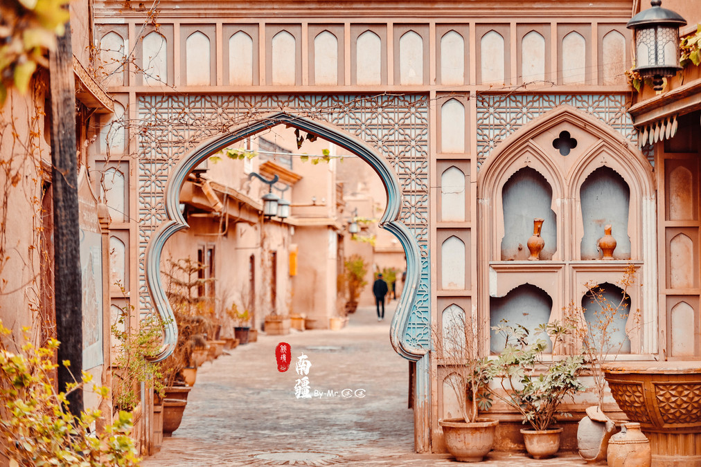
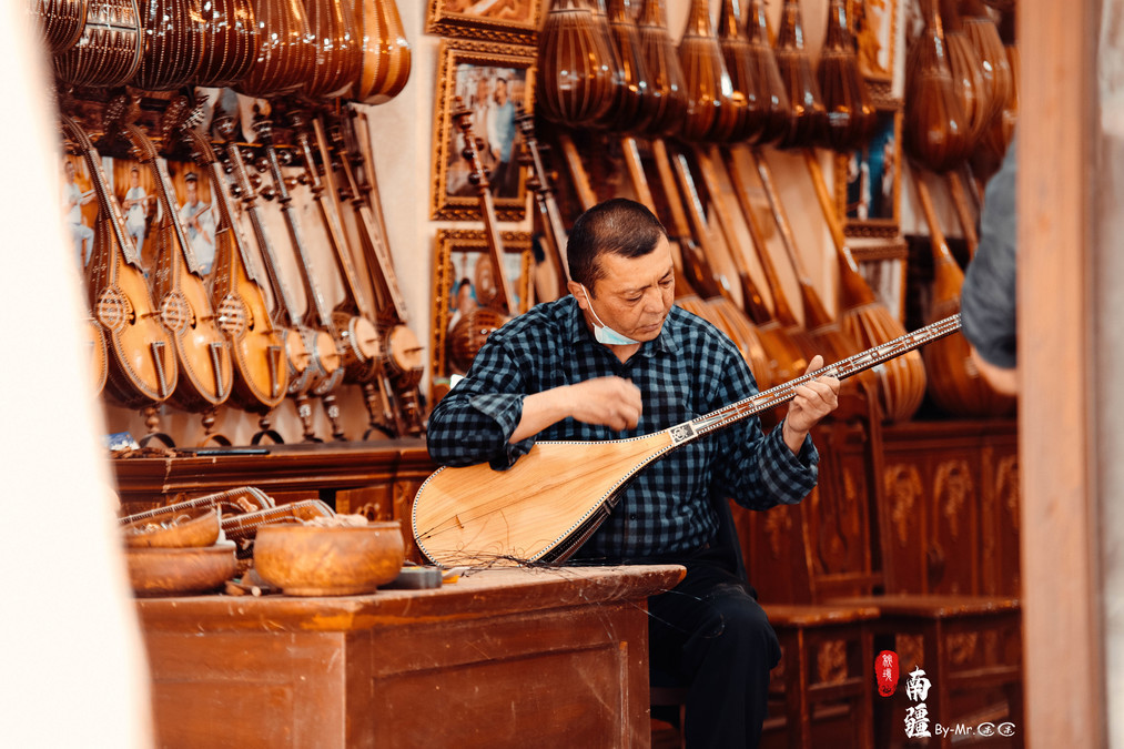
Kashi is also known as the paradise for photojournalists. The renovated old city of Kashi should be the one with the most "ancient flavor", compared to the modernized ancient city and ancient town that have undergone a complete makeover. In contrast, the old city of Kashi is more like an ancient city that has remained unchanged for a long time.

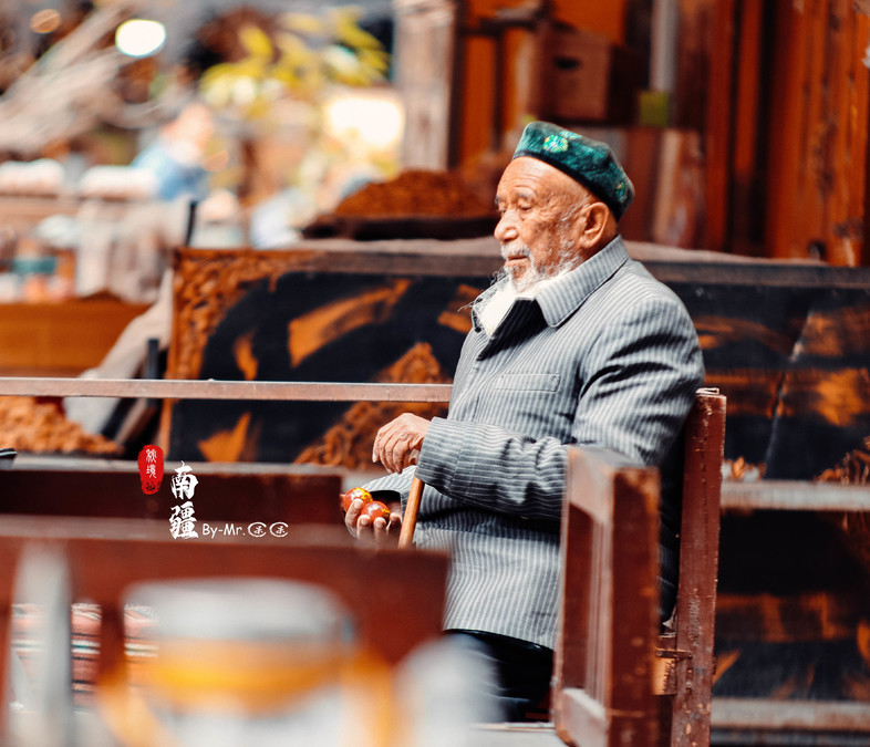

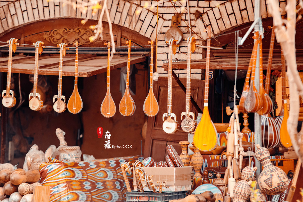

The century-old tea house in Kashgar has now become a must-visit spot for tourists coming to Kashgar. This century-old tea house has witnessed the changes of Kashgar over the past century. On the second floor, against the wall, there are several large wooden benches. Guests take off their shoes and sit on them, drinking tea, chatting, and watching the Uyghur people singing and dancing.
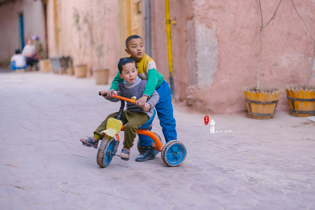
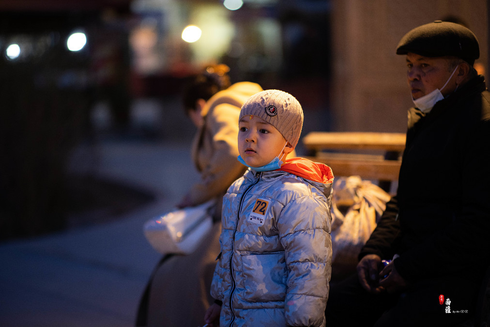
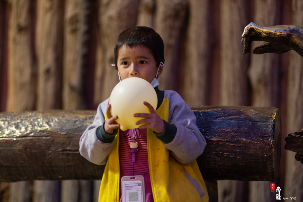
In the afternoon, the old town gradually became lively as the children's dismissal bell rang.
Three-wheeled tricycles are very popular among children. One can always see them joyfully moving around in the streets and alleys.

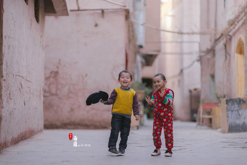
After this little kid put on his new hat, he started running around frantically beside me. At that moment, the camera was set on 85mm, and he kept approaching my camera lens. The focus was really difficult to get!

A very shy little boy

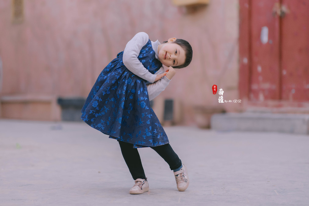
This adorable little girl has a natural talent for dancing. Whenever there is a camera pointed at her, she starts dancing gracefully. After asking, it turned out that her father taught her to dance. Indeed, people in Xinjiang are all excellent dancers. Dancing should be started from childhood!
A father was teaching his three children how to sing. He always felt that the two children on the left looked like twins.

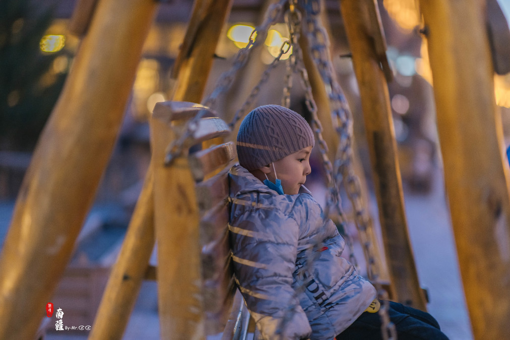
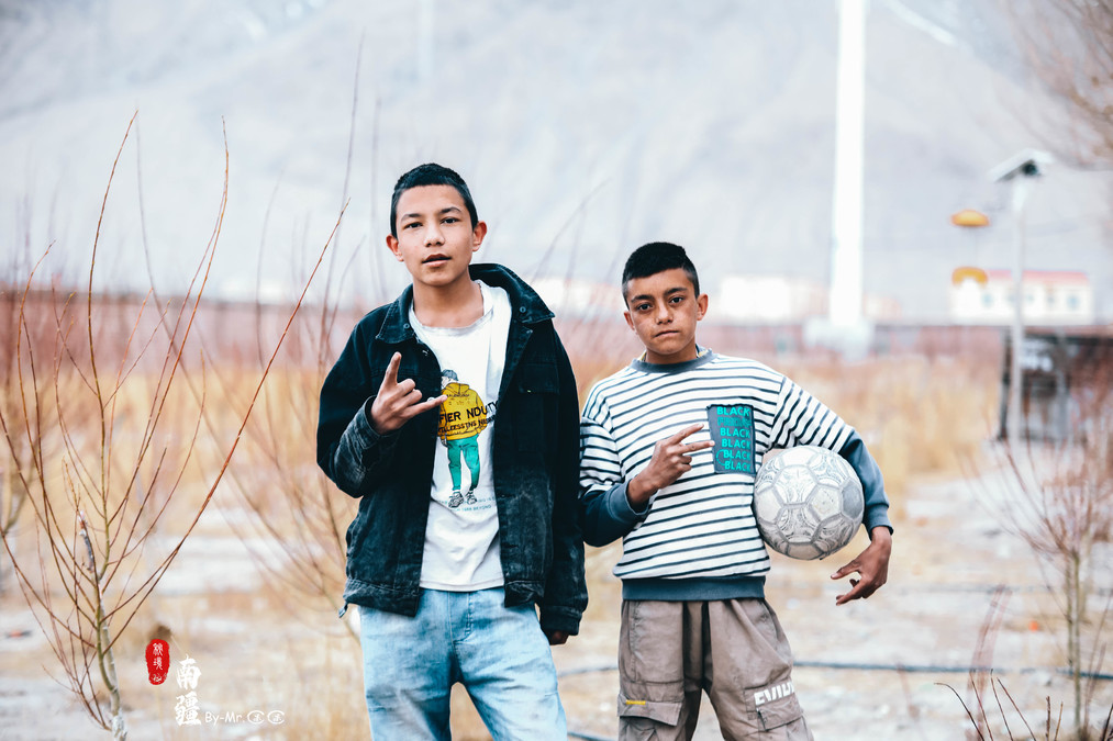
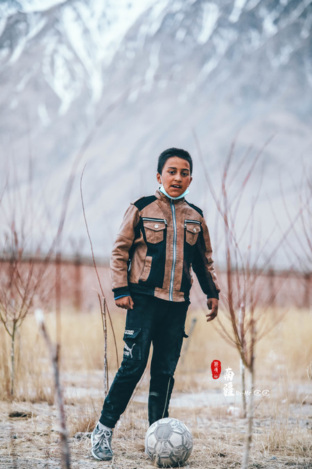
The sky was getting darker, and the little boys were playing football on the open ground.


The parent of one of the children wouldn't allow him to play football, so he could only watch the other kids having fun on the square with longing in his eyes. In the end, he angrily sat in a rocking chair and ate lollipops.
The old town under the night sky, with lights twinkling.


Under the night sky, in the old town, the lights are twinkling, with a touch of red beneath the Oyatak Glacier.
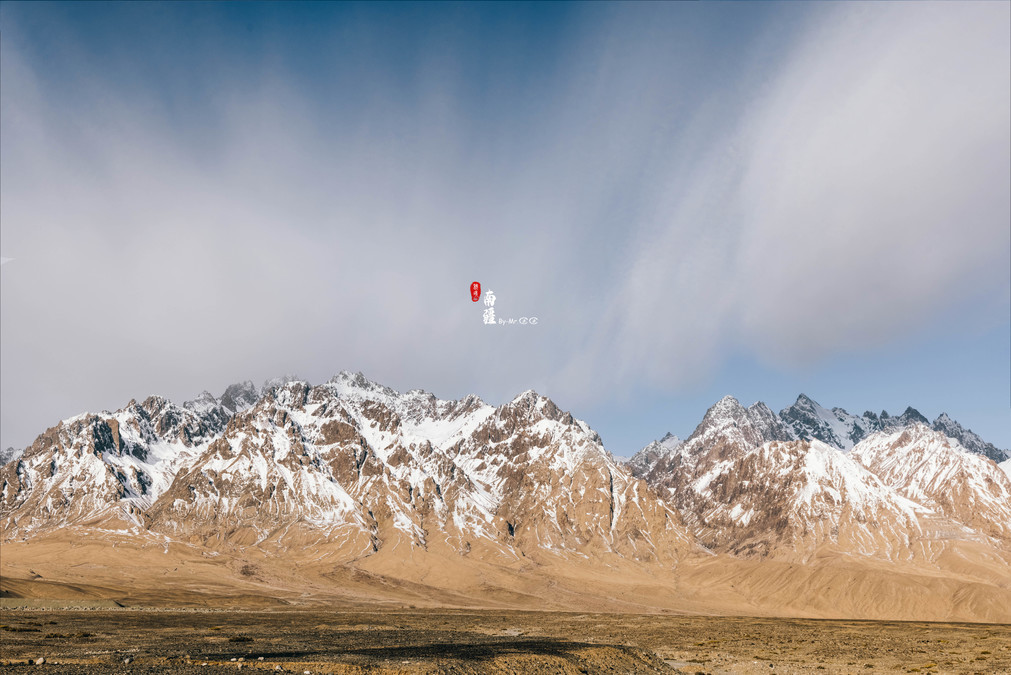
The Pamir Plateau, formerly known as the "No-Wall Mountain", has a towering mountain structure with an average altitude of over 4,500 meters. The main peaks are all above 6,000 meters. The ancient Silk Road passed through here. It is located in the southeastern part of Central Asia and the westernmost part of China, spanning Tajikistan, China and Afghanistan. The Pamir Plateau spans the southwestern part of Xinjiang in China, the southeastern part of Tajikistan, and the northeastern part of Afghanistan. It is a huge mountain junction where the Kunlun Mountains, the Karakoram Mountains, the Hindu Kush Mountains and the Tianshan Mountains converge.
The Pamir Plateau was also the main destination of our journey, where we went to explore "The Visitors Beneath the Icebergs".
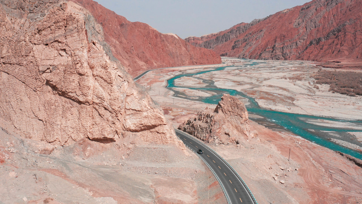
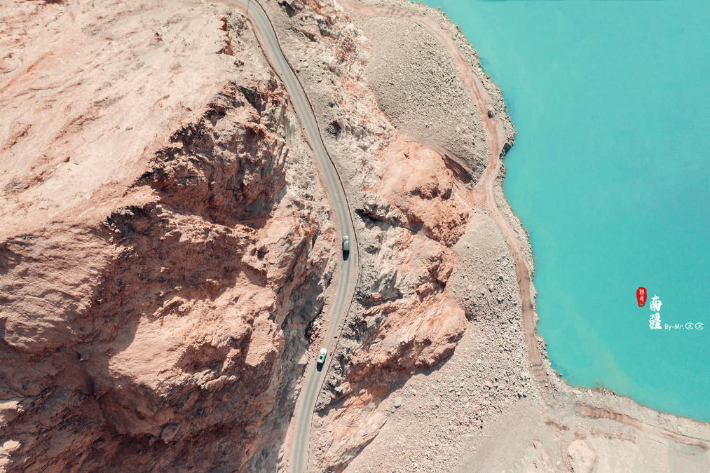
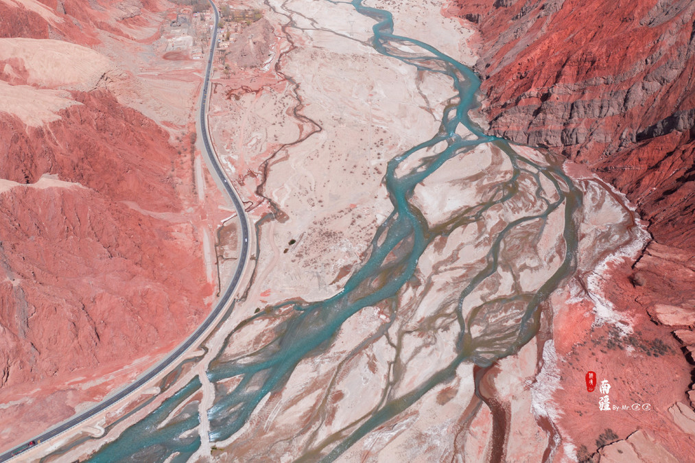
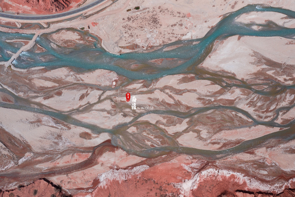
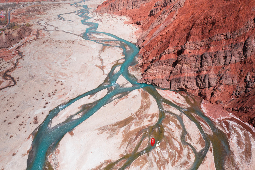
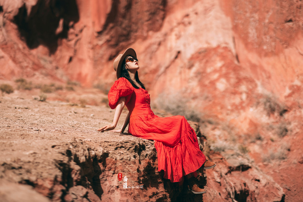
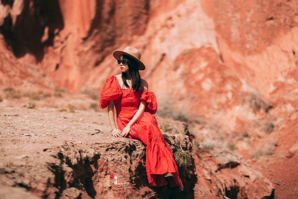
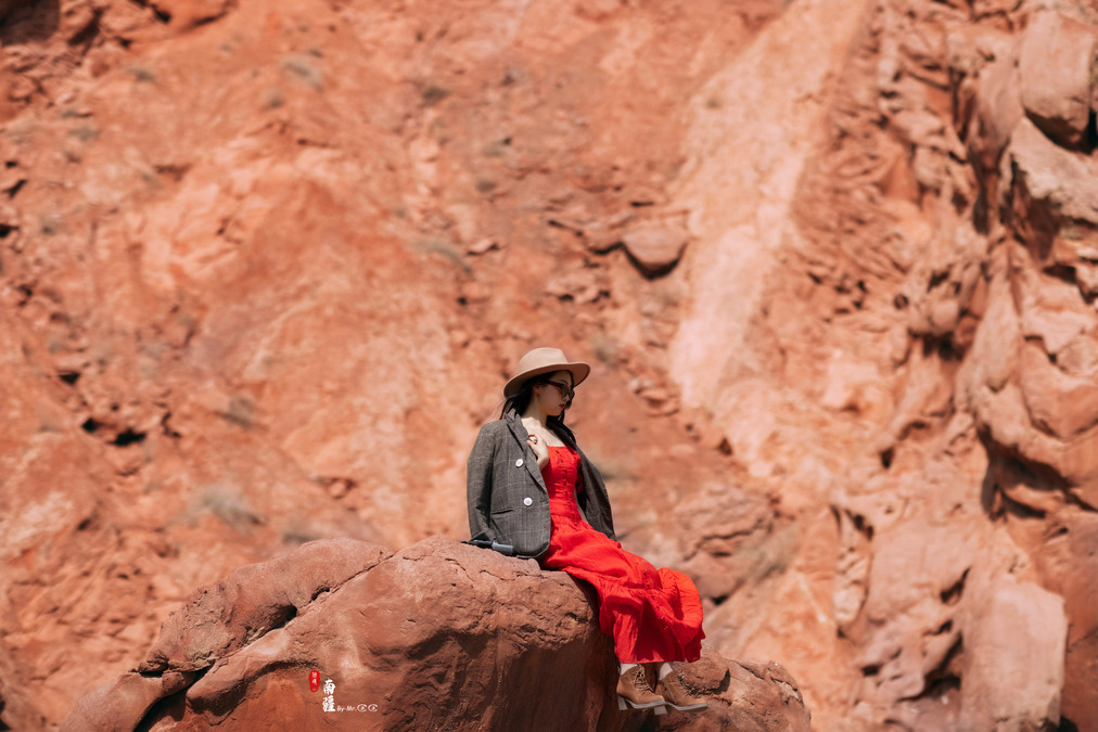
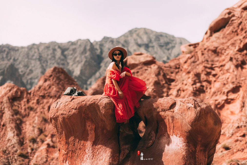
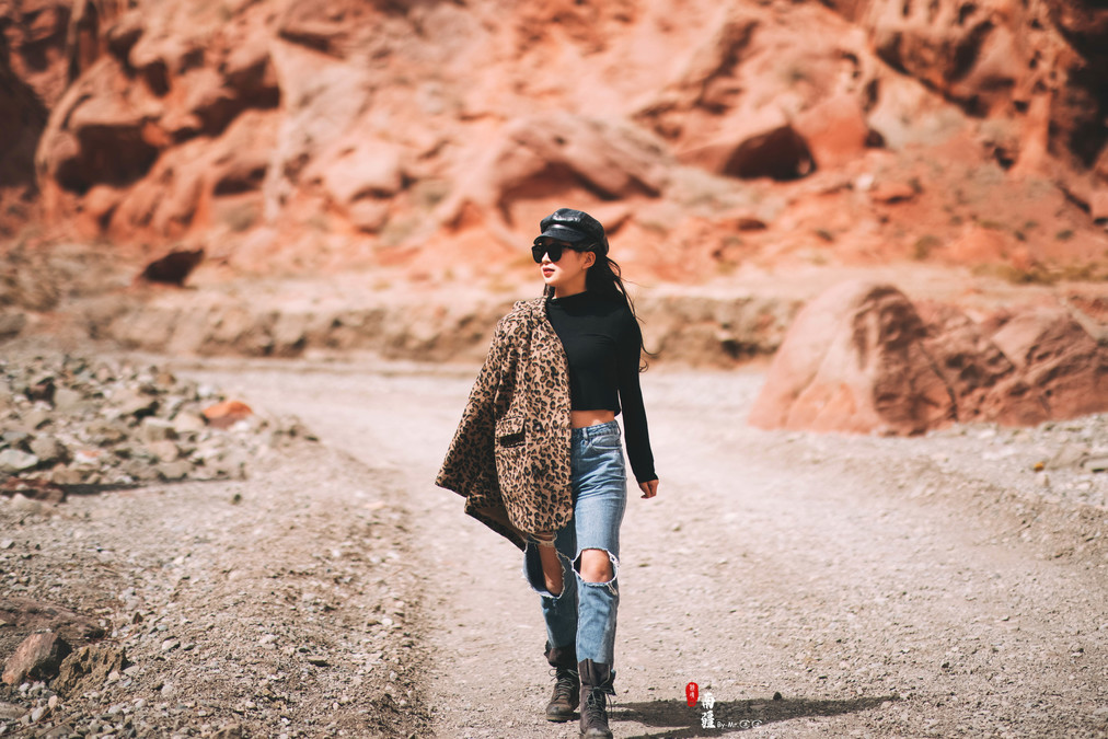
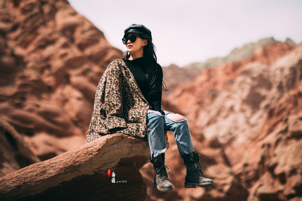
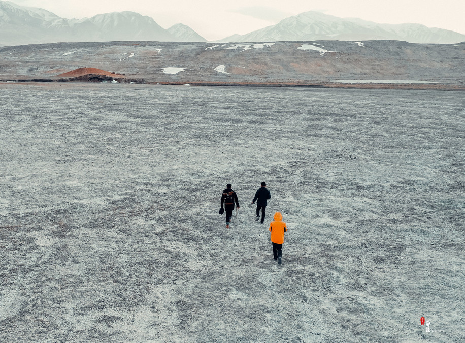
After leaving Kashgar and traveling 90 kilometers along G314, you will see the Ouyitak Red Mountain, which is known as the South Xinjiang Flame Mountain. Ouyitak is located at the foot of the Pamir Plateau and has rugged terrain with numerous strange rocks. After reaching the Ouyitak Glacier Park, continue walking for about 3-4 kilometers. At a turning point, you will see a slope without guardrails that can be descended. Driving in will reveal a red canyon.
In the distance are towering snow-capped mountains, in the middle are black mountains, and at the very front it turns into a streak of red.

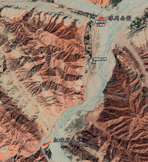
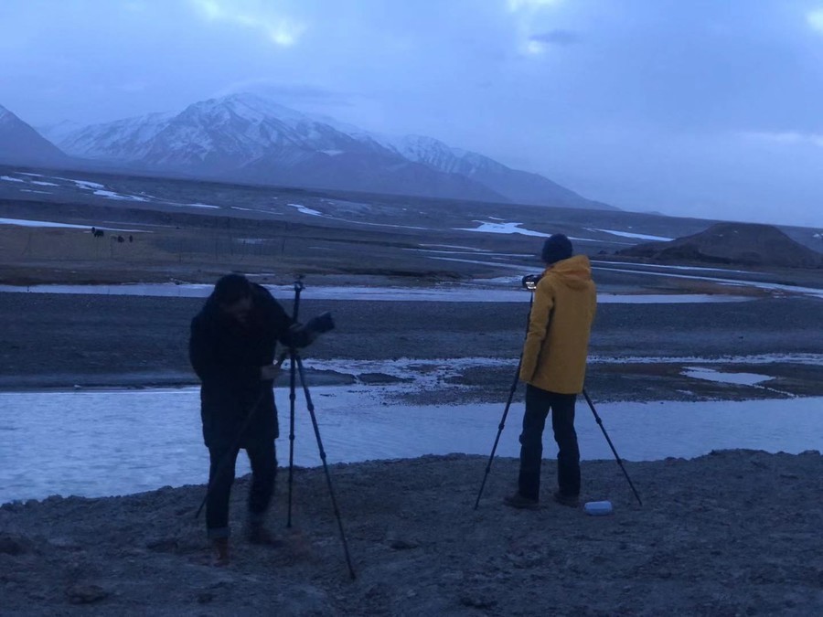
For aerial photography, it is recommended to take off at the entrance of the canyon. The signal inside the canyon is very poor. Along the road, you can see a unique scene where the canyon, the road and the river blend together in three different colors.

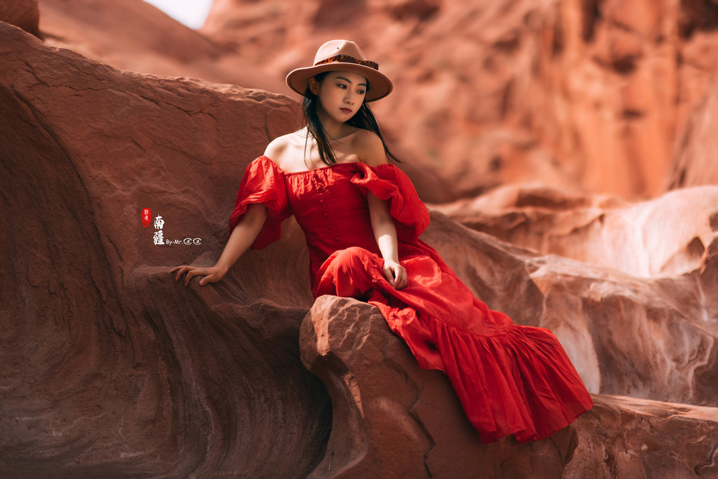
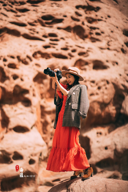
There are many strangely-shaped rock walls in the canyon. The outfit can be paired with a long dress to look gentle and feminine. Just a slight pose can create a sense of grandeur. The fellow traveler L was wearing a red long dress, complementing the red canyon perfectly.
Jingjing's jeans make her walk with a cool breeze!
On how a photo is created~~~
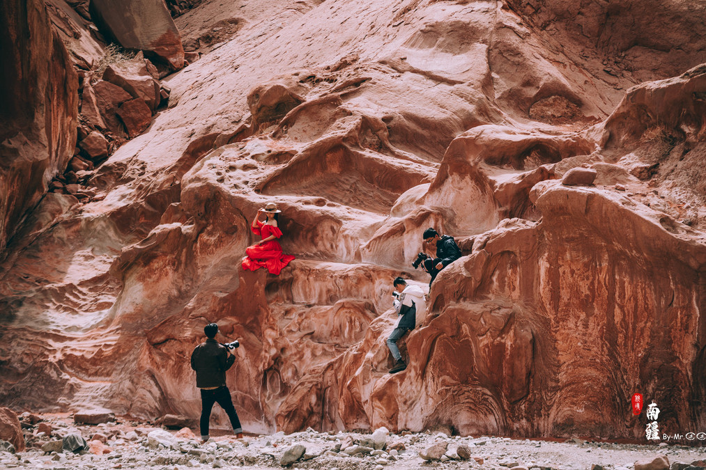
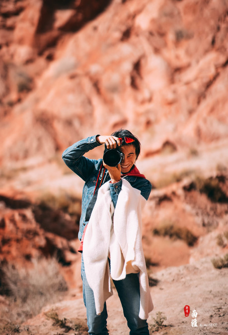
This time, I went out with many photographers. Finally, I won't have the situation where I don't have any photos to show every time. Thank you all for the many photos!

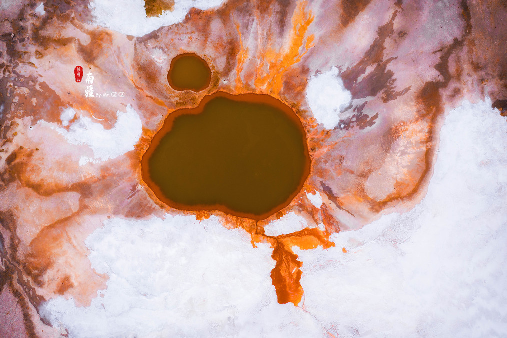
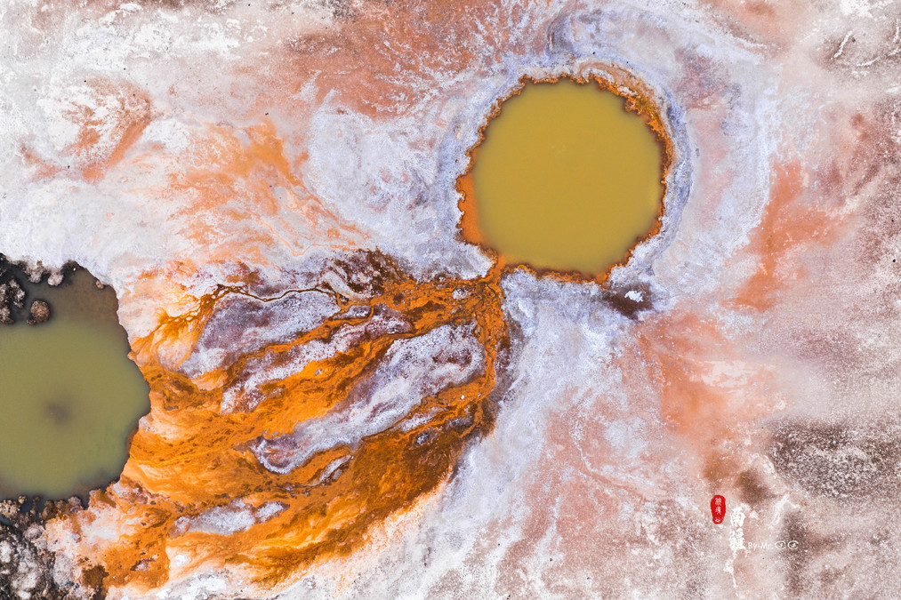
Mujie Volcano - The Color of the Earth
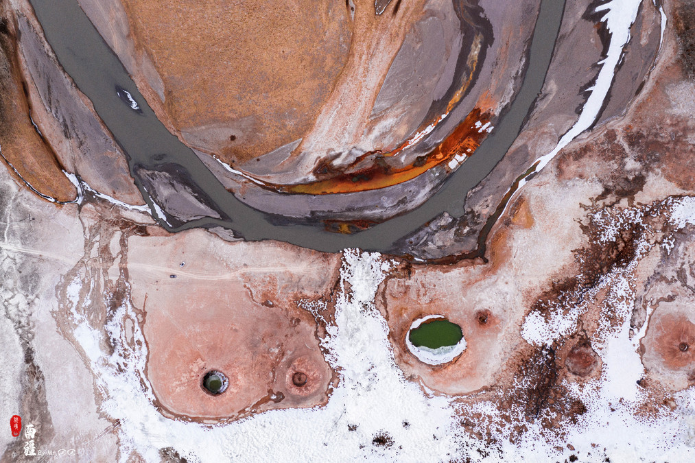
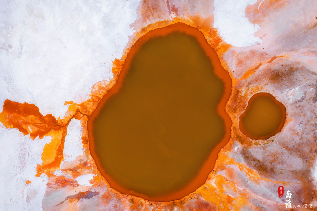
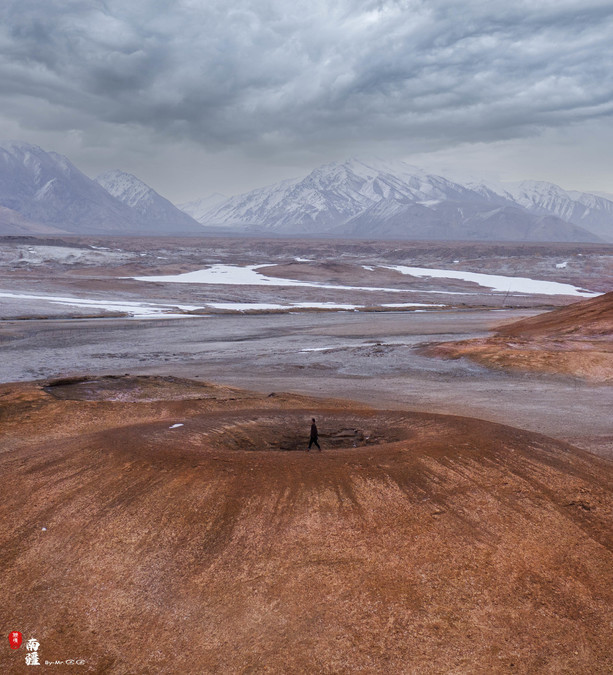
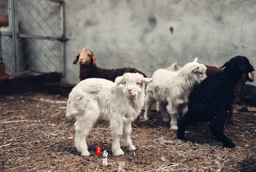
The Muji Volcano, officially known as the Karizhimir Volcano Group, is located in the northwest of Aktao County, near the Muji Township. It is estimated to have formed 1,500 years ago and has more than a dozen volcanic craters of various sizes. Many of these craters are remarkably well-preserved. It is the highest volcanic crater in Xinjiang and erupted a long time ago. Currently, it is a dormant volcano. The surrounding area is a network of wetlands. The variously colored volcanic craters are filled with minerals of different colors, forming unique geological features such as glaciers, glacial lakes, and ice caves.
Because we spent a considerable amount of time at the Oyatake Red Mountain, we decided to go to the crater first, and then stop at Baisha Lake on the way back. When we were almost reaching Baisha Lake, there was a border inspection station. After passing the border inspection, we headed towards the Muji Township. When we were close to Muji Township, there was a sign indicating to go to the crater. We could directly drive to the vicinity of the crater, where there are local residents' houses. We are recommended to stay there. The cost is approximately 80-100 yuan per person, including dinner and breakfast. We stayed in a large bunk bed, which was heated and not cold.
It's only a few minutes' drive from the accommodation place to the crater. However, the road is not very good. The car can directly drive under the first crater. The crater is not very high and it's possible to climb up on foot.
Mujie Volcano is another scenic spot suitable for drone photography. The crater of the volcano is relatively small. If the photographer and the model stand at the crater, it will give the impression of being near a large puddle. It is suitable for standing or sitting, and then the drone can be slightly moved away to capture the entire crater (Ladies, the red dress and the volcano are a perfect match).

Further inside, there are numerous large and small volcanic craters with unique shapes. In March, the weather was still snowy, adding a touch of white to the volcanoes.
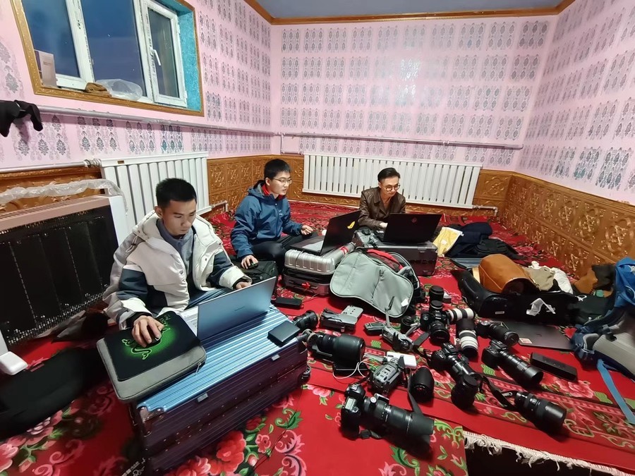
After having a full meal and rest every day, here's what my daily routine looks like. Tonight, I was supposed to go back for dinner after watching the sunset. But due to various reasons, they were delayed. We didn't have dinner until nearly 12 o'clock. It's hard to imagine that we didn't have lunch either. Editing photos made my head spin and I felt so hungry that I never felt this way before~
The next morning, I planned to get up early to capture the sunrise. I set off before dawn. Originally, I could have followed the tire tracks during the day, but now it's pitch-dark and I can't see anything at all~
The clouds are still a bit thick today. After waiting for a long time, we could only vaguely see the sun emerging from behind the snow-capped mountains.
The rear part of the volcano vehicle couldn't be driven through, but people could walk in. While taking the time to take time-lapse photos, we plan to explore further. Inside is a wetland. The weather is rather cold and the land is frozen. If you come here in summer, you need to be careful whether the ground is passable when entering.
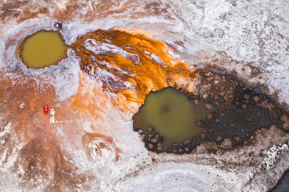
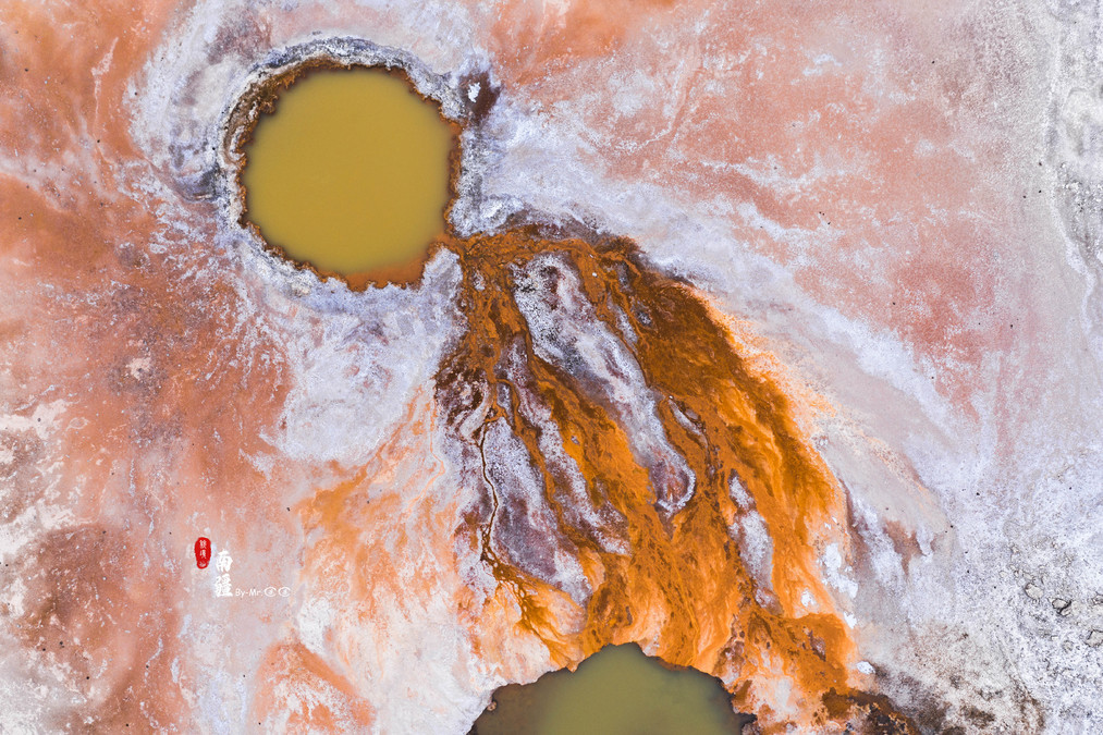
About 1.5 kilometers along the river, at a U-shaped bend, there are two small craters on the ground, which are hardly noticeable from the ground level. However, from an aerial perspective, they instantly become three-dimensional. The two craters, the left one is red and the right one is black. The minerals in the left crater are slowly flowing to the right. The U-shaped river is like a big mouth, and from the front, it looks like a traditional Chinese opera mask. To cross these craters, we need to cross this river. Due to time constraints, we didn't have a way to cross the river. Regrettably, we could only fly a drone nearby to take pictures.
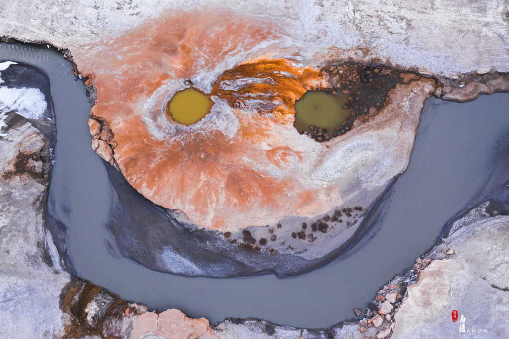
Zoom in the camera and when you focus solely on the two craters, it feels as if they are two swimming fish!

Show a close-up on the left side, and it seems like a person who is dancing. With different angles and different imaginations, the pictures you see will be completely different.
The Ice Age in Baisha Lake
After leaving Muji Volcano, we passed by Baisha Lake. Baisha Lake is a necessary route leading to Ta County. The origin of the name "Baisha Lake" might be because of the white sand mountain beside the lake. The formation of the Baisha Mountain was when water carried by rivers gathered here to form the lake, and the white sand that was deposited during the cold seasons when the water level dropped emerged and was blown up the hillside by the ceaseless strong winds. Over millions of years, this has resulted in the extraordinary scene of sand accumulating to form a mountain.
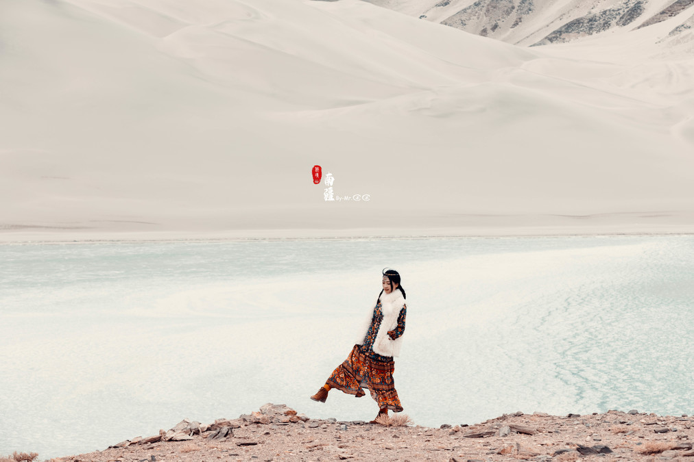
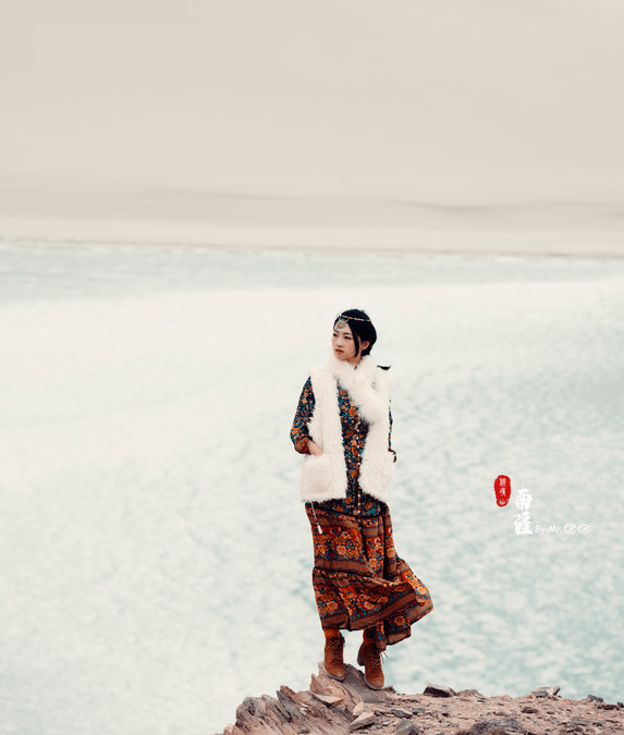
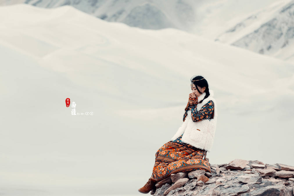
Snapshots always bring you unexpected gains. At the end of March, Baisha Lake was still rather cold. A girl dressed in ethnic clothing was sitting by the lake. Facing the chilly air, she placed her hands over her mouth and blew out breaths, her eyes slightly closed, as if praying for something (Thinking about it, isn't this quite poetic?)
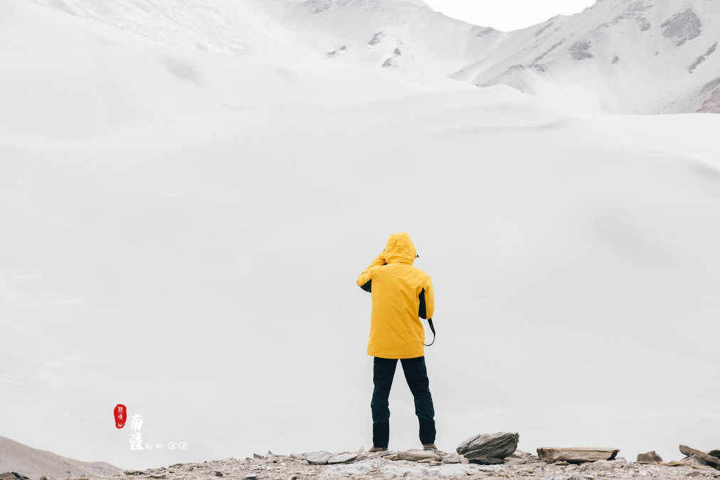
My impression of Tony seems to be all about his back!

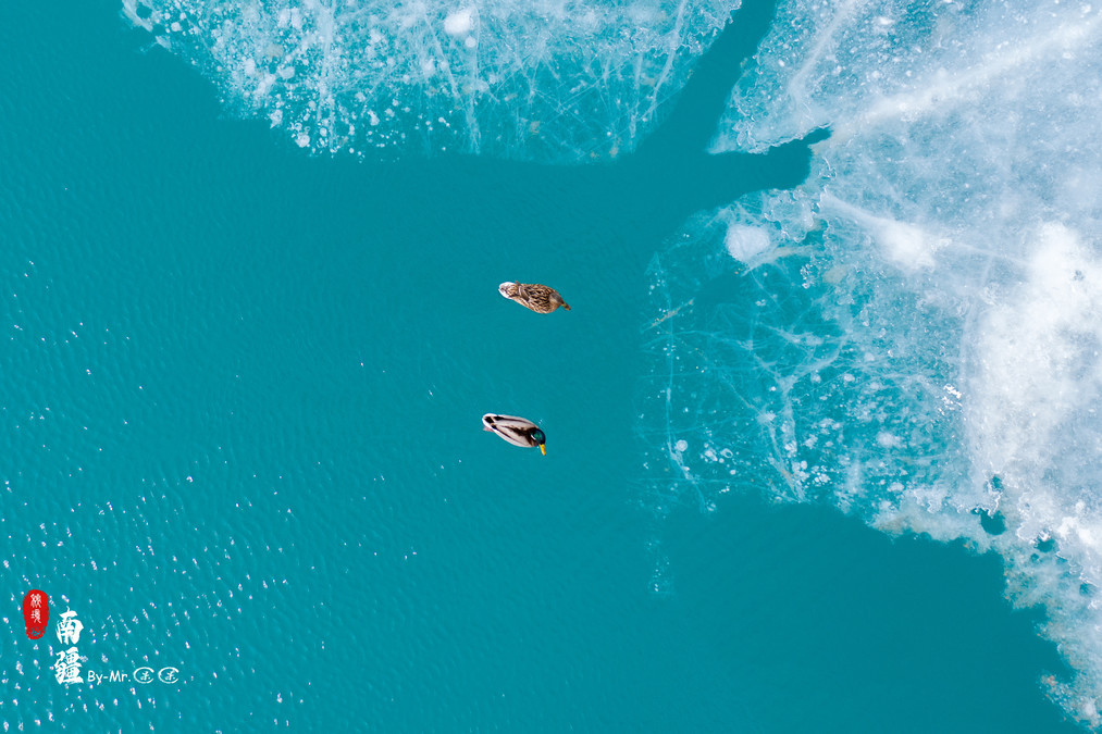
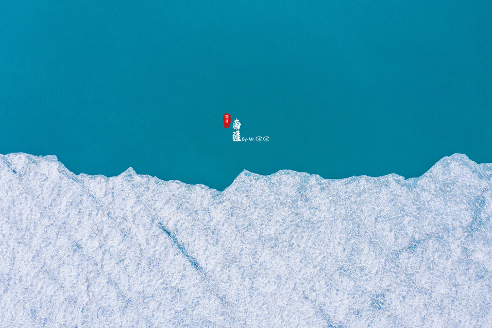
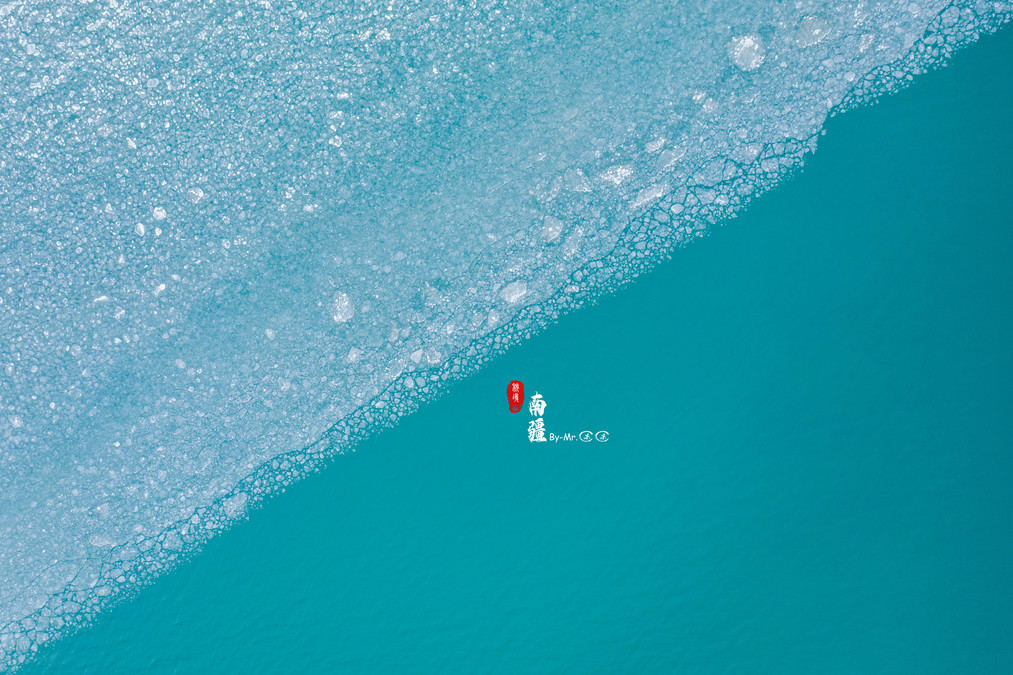
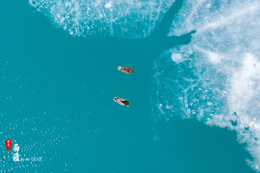
At the end of March in Baisha Lake, the ice is gradually melting, resulting in a landscape that is half white and half dark blue.


Two ducks swam together. During the Ice Age, having your company brought a touch of warmth to the still cold lake surface.
The visitors beneath the iceberg
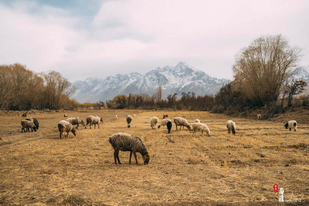
Tachkurgan County is located at the foot of the Pamir Plateau. In the Uyghur language, "Tachkurgan" means "Stone City". Here, the indomitable Tajik people live, accompanied by the snow-capped mountains. "Guests Under the Ice Mountain" tells the story of their lives.
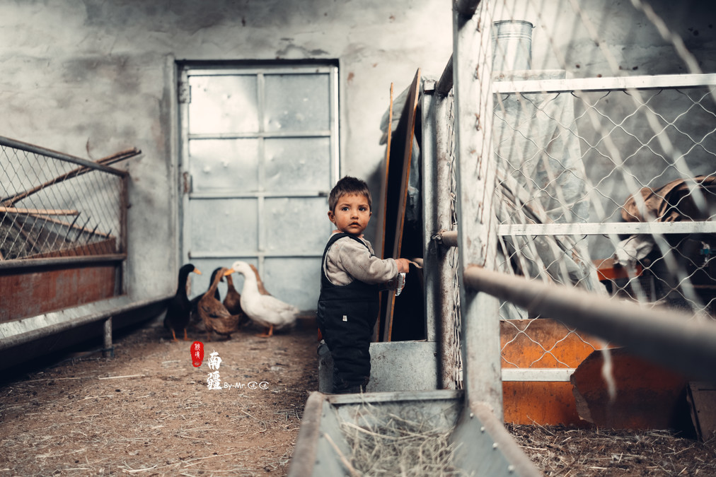
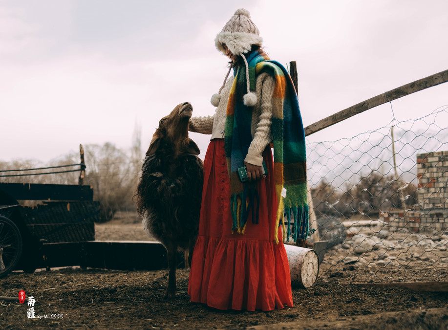
We arrived in Taya County around 4 p.m. The county is surrounded by many houses of the Tajik people. So we decided to visit the local residents' houses. After all, which girl could resist the temptation of cows and sheep?
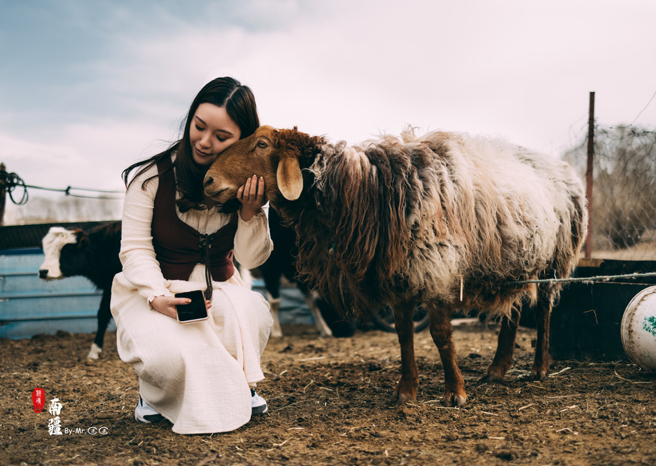
Under the snow-capped mountains, the sheep are leisurely grazing on the grass.

While passing by a house, I was deeply attracted by the little kid inside. I quickly took out the egg yolk pie to tempt him, successfully capturing a cute little one. Then I smoothly entered the tent where the baby lambs were kept.
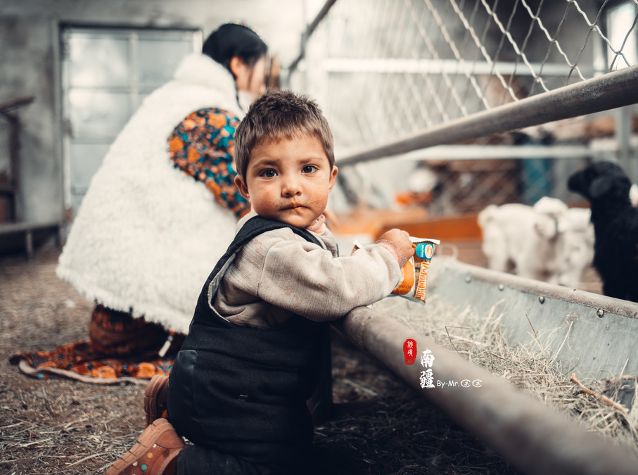
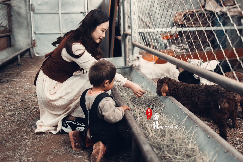
Perhaps it was because of the excessive excitement. After stepping out of the sheep pen, it suddenly fell and landed on the ground with a thud. But as soon as it got up, it couldn't help checking if the egg yolk pie in its hand was still intact.

In the end, the egg custard pie was still eaten by the sheep!
It's quite strange, but after eating the egg custard pie, this sheep became extremely docile. No matter how much it was stroked, it always looked very content and would even raise its head from time to time, looking very affectionate.
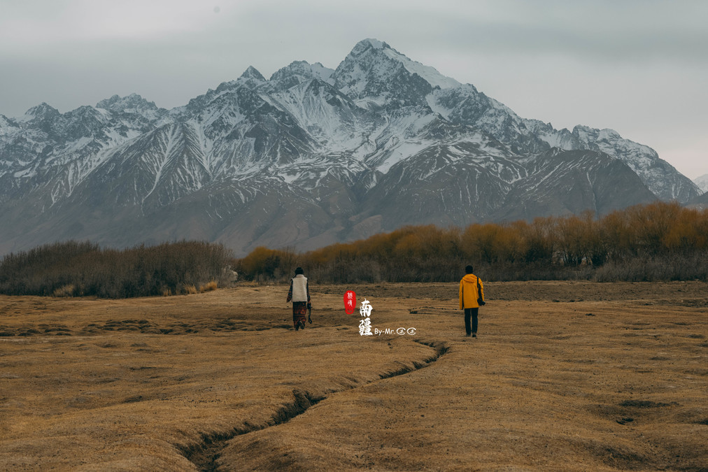
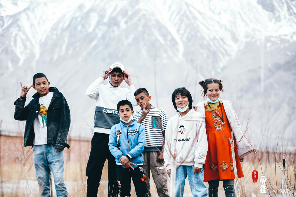
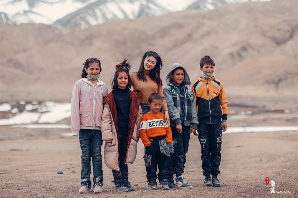
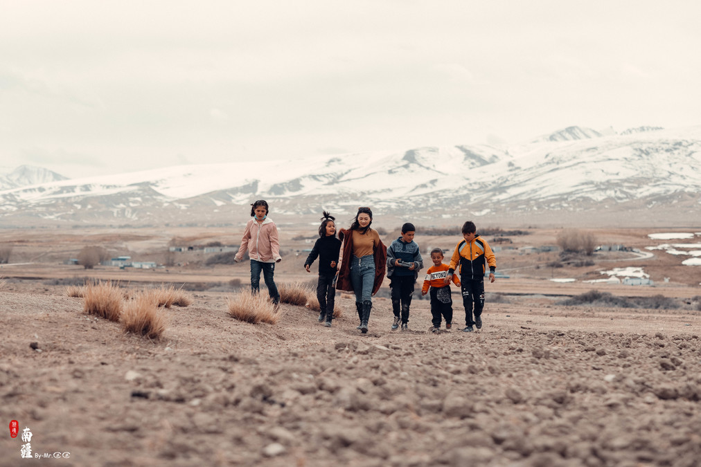
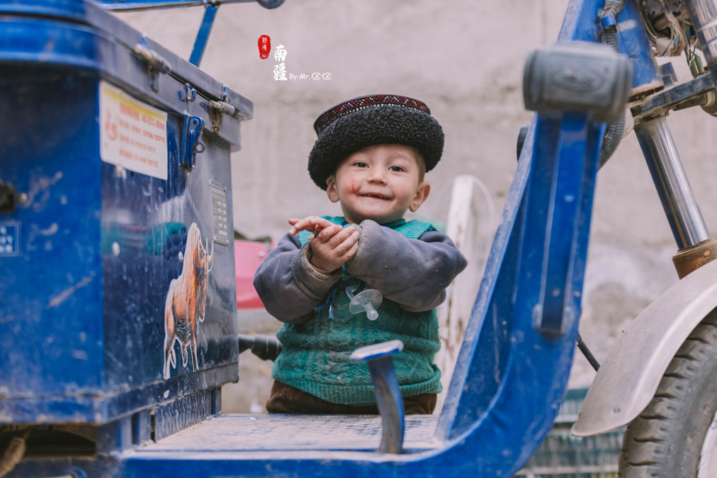
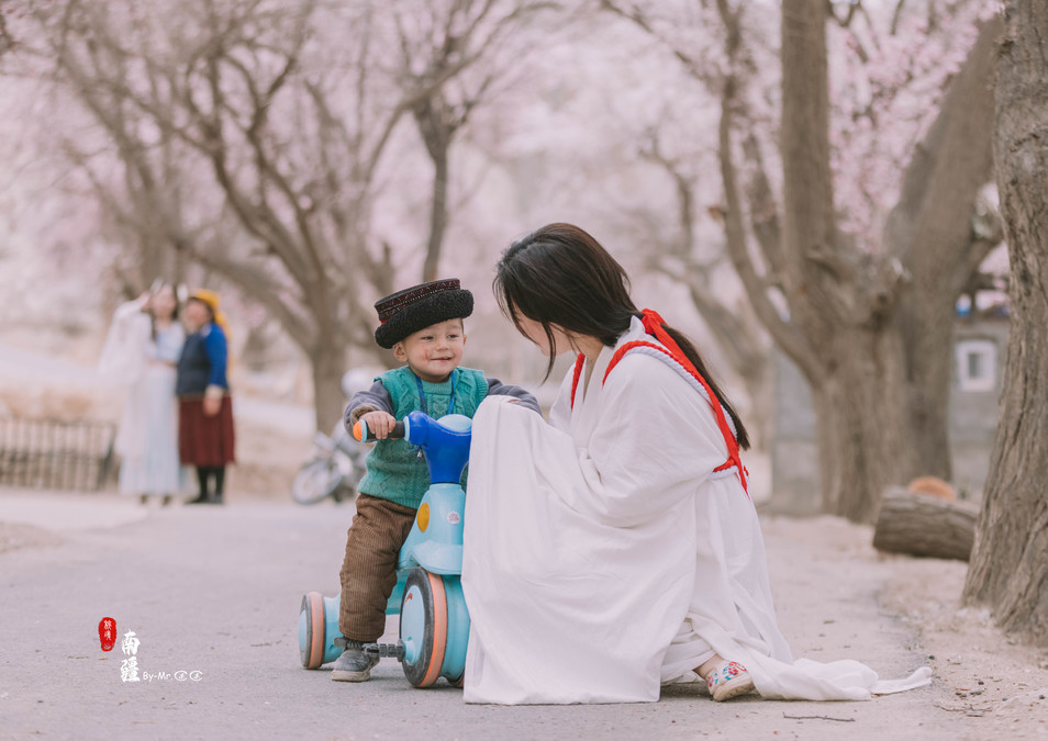
Under the snow-capped mountains, Duoduo also came across a group of children. Looking at their innocent faces, she couldn't help but recall her childhood when she would walk around in the fields after school. Indeed, people tend to be nostalgic.
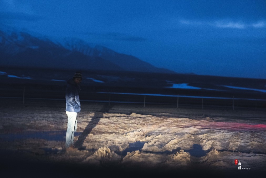
Just outside Ta County, on the road leading to Hongqi Lapu, the right side of the road was covered with snow-capped mountains. Fortunately, the weather was fine that day. There was a sign at one of the intersections indicating it was the way to the airport. Does Ta County have an airport? It seemed possible to turn in, so I turned and parked near the checkpoint to take a time-lapse photo. The time-lapse shooting team has arrived!
Surprise and delight
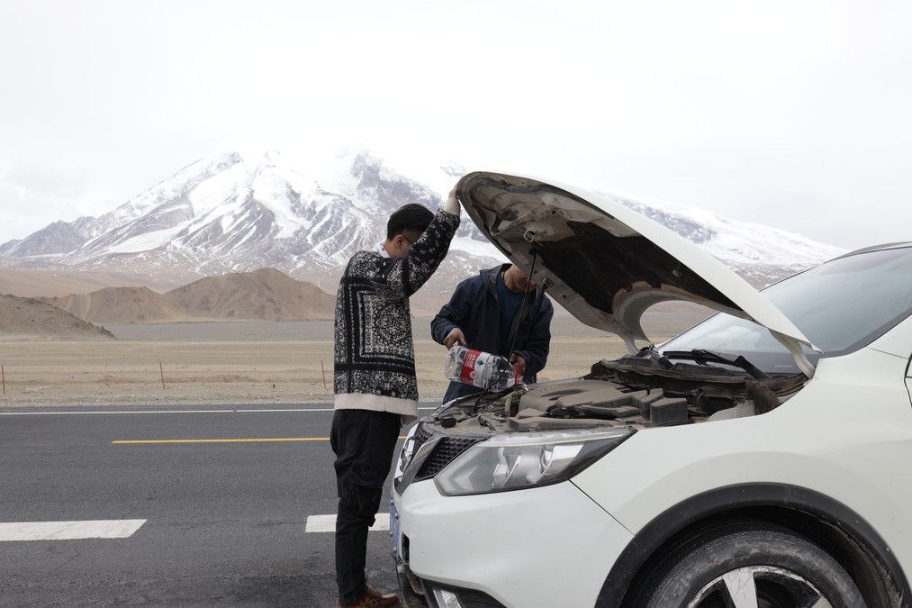
Every trip comes with uncertainties. So this time, when our car was heading towards Panlong Ancient Road, due to an attempt to pass over a small hill, the speed was not controlled properly, and the front bumper was damaged. The water tank also cracked, and the antifreeze was gushing out noisily. The driver in the rear seat, L, also hit the roof of the car due to the jolts. At that moment, everyone was panicked. Fortunately, this trip had two vehicles on board. Since the distance to Taya County wasn't too far, after discussion, it was decided that Wangzai would drive and take L to the hospital, while Tony would drive the car slowly behind to go to Taya County first to check the situation.
Fortunately, the Xian was fine after the inspection. However, the car itself was a bit complicated. After it was sent to the repair shop for inspection, it was found that the upper part of the engine coolant reservoir was cracked. This situation required replacing the entire reservoir. But in Taian, they couldn't find the reservoir for this model of car. They could only have it shipped from Kashgar. This would inevitably delay the journey. Finally, they decided to drive back to Kashgar that day and directly change to another car. So, the three-person car replacement team consisting of Tony and Wangzi set off. They bought two large buckets of antifreeze and used it to cool the engine on the way.
The distance from Taya County to Kashgar is nearly 300 kilometers. We underestimated the damage to the vehicle. After the water tank broke, the coolant quickly evaporated when the engine was running. We could only travel at a slow speed and had to stop from time to time to add coolant.

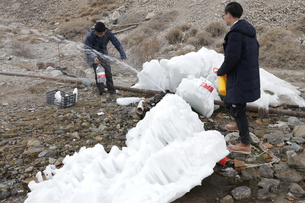
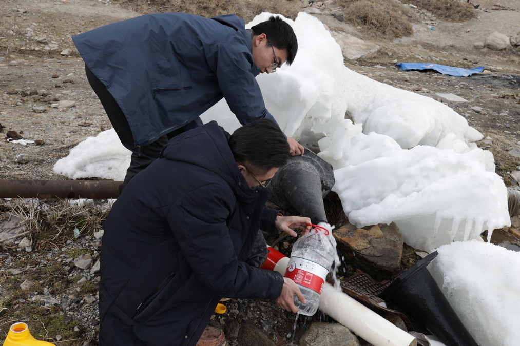
If this continues, the antifreeze in the car will definitely run out. After discussing with the car rental manager, it was permitted to use mineral water instead of the antifreeze and add it to the tank. So, I bought two large boxes of mineral water at a convenience store and added water frantically throughout the journey.
While passing by the roadside, they noticed a pipe leading out of a glacier water supply. The three of them immediately stopped the car and filled all the empty buckets to the brim.
Sometimes, surprises can come along with accidents. When we went to Taixian County, the sky above Baisha Lake was filled with thick clouds. When we returned to Baisha Lake again, we saw the warm sunlight passing through the clouds and shining on Baisha Mountain. As time went by, beautiful shadows were formed.

After a bumpy journey all the way to Kashgar, it was already midnight. To avoid delaying the trip, we changed to a new vehicle, had a bowl of noodles, and then set off without stopping for Taixian County. That day was a full moon, and at 4 a.m. when passing by Gong'er Jiubie Peak, under the moonlight, the mountain body of Gong'er Jiubie Peak shone brightly. Streams of white clouds quickly passed over the peak, and above the clouds, there were numerous stars.
The cheerful voices and laughter in Wacha Township
Originally, the plan was to take the Panlong Ancient Road from the area of Taya County to Hongqi Lapu Road. After leaving the Panlong Ancient Road, one could directly reach Daxing Township from Wacha Township.
When we got there, we found that by the end of March, the snow on the mountain top had not yet melted. After a thorough assessment, we concluded that driving through there was too risky.
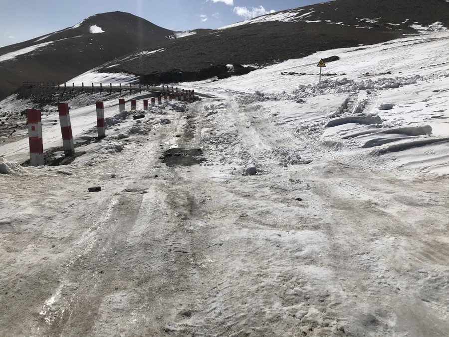
Finally, it was decided to go directly from Taya County to Wacha Township, and then take the Panlong Ancient Road from there.
Under the Panlong Ancient Road, when passing through a small village, we were pulled out by the friendly children and they took us to play on the vast and fertile land.
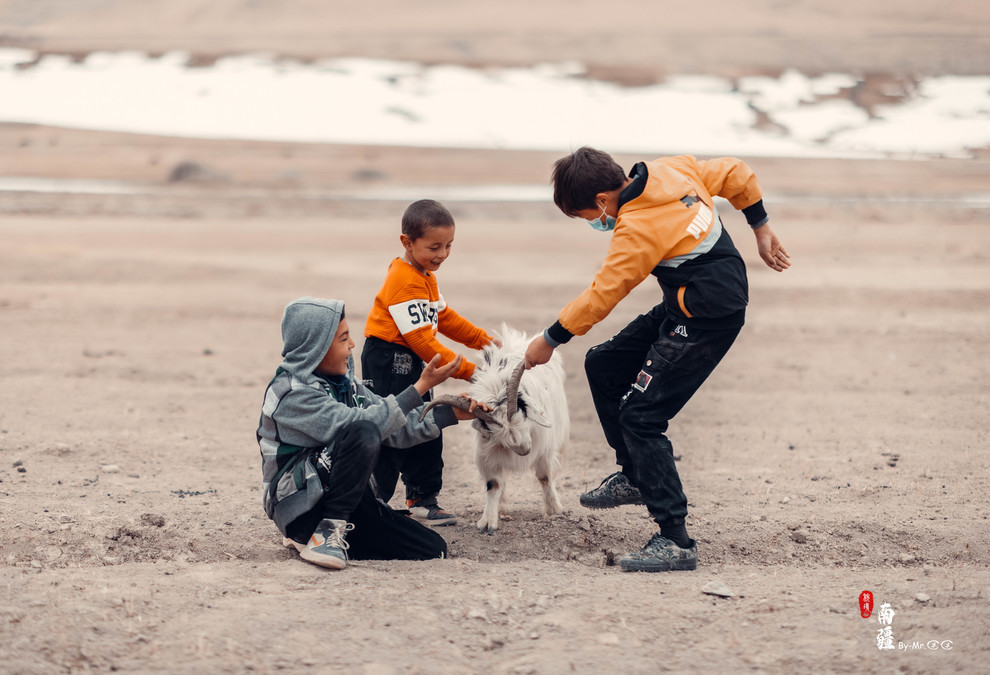
Three naughty children asked us if we wanted to see the sheep, then dashed off in the distance, holding their cameras but failing to catch up. After a while, they led a sheep over to us. Poor little sheep, it was almost pulled over by having its horns grabbed!
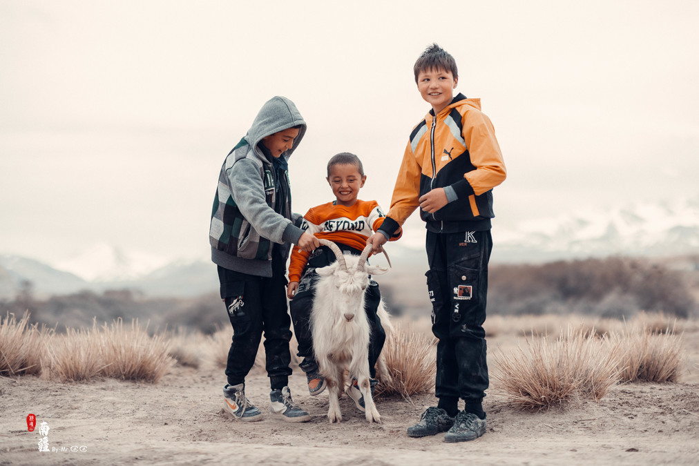
When L took out the drone to let these little ones play with it, she had already become the king of their play.
Where Qiqi was looking far away, that was exactly where the Panlong Ancient Trail was located.

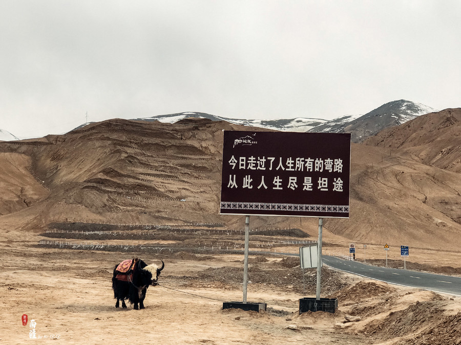
Today, I have traversed all the detours in life.
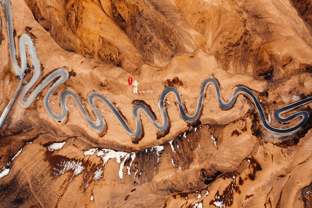
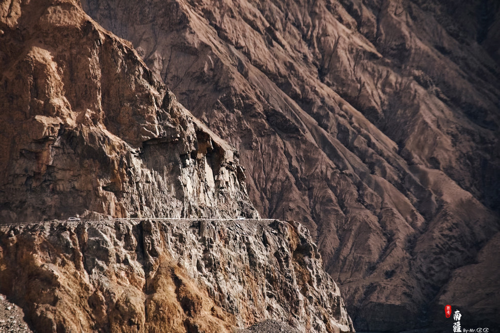
The Panlong Ancient Road is located near Wacha Township. At the bottom of the mountain, there is a very inspiring saying, "Today, I have overcome all the detours in life. From now on, my life will be full of smooth roads!" Looking at the winding mountain road stretching as far as the eye can see behind the signpost, one can't help but marvel at the greatness of "Made in China".
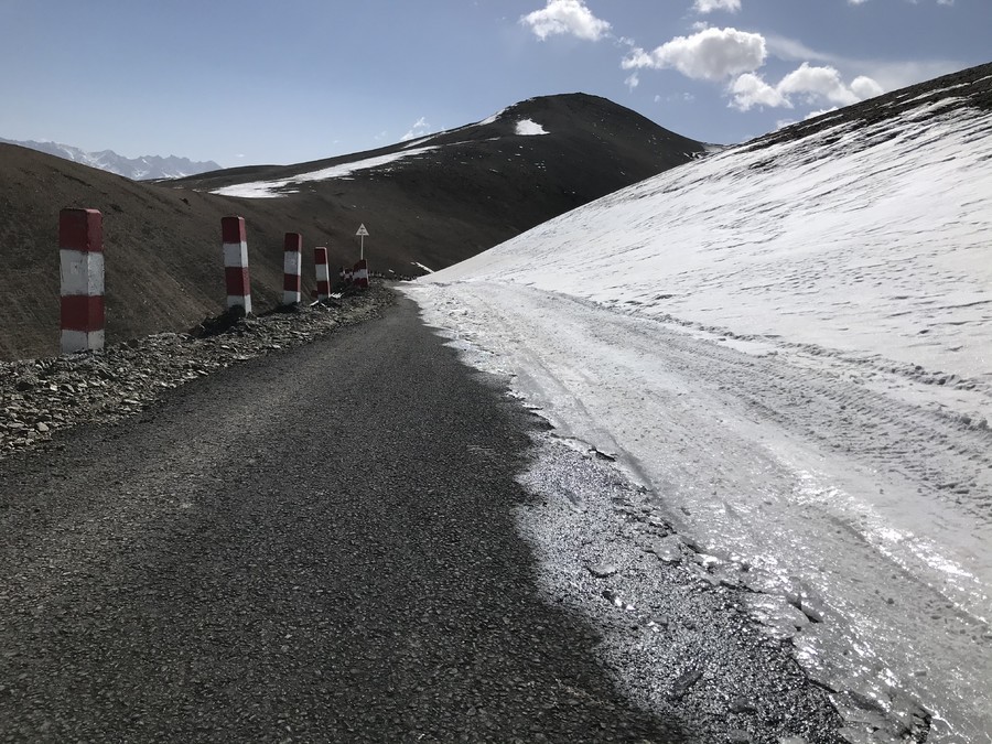
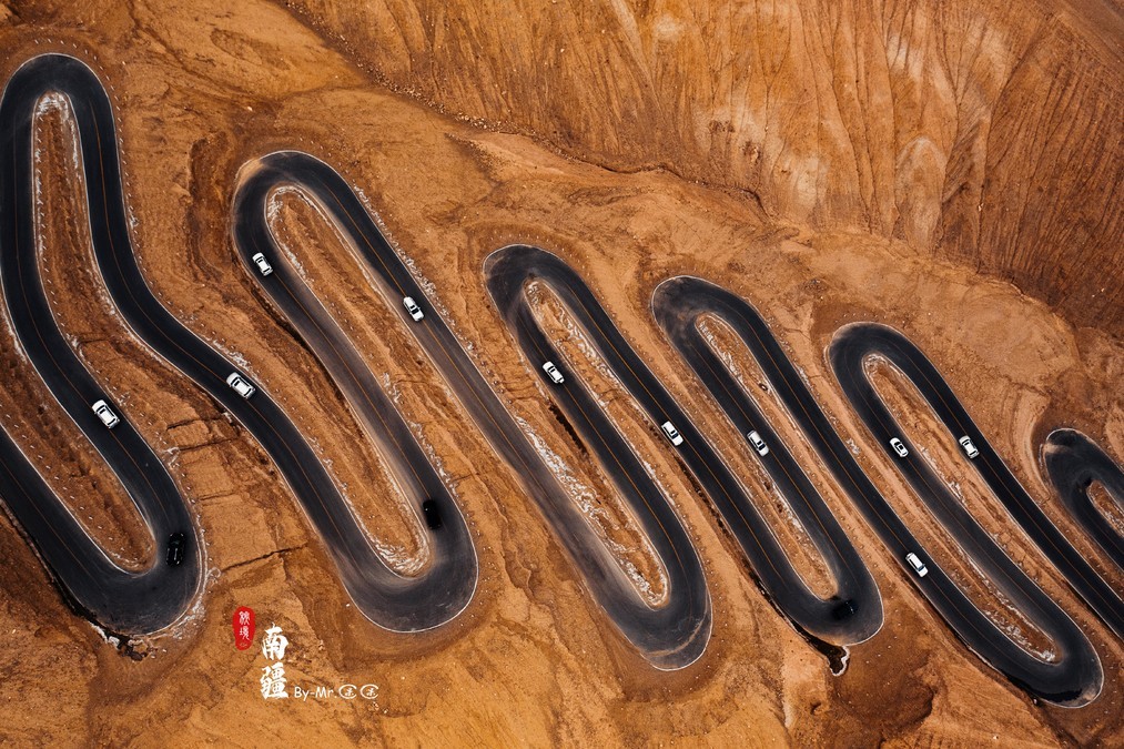
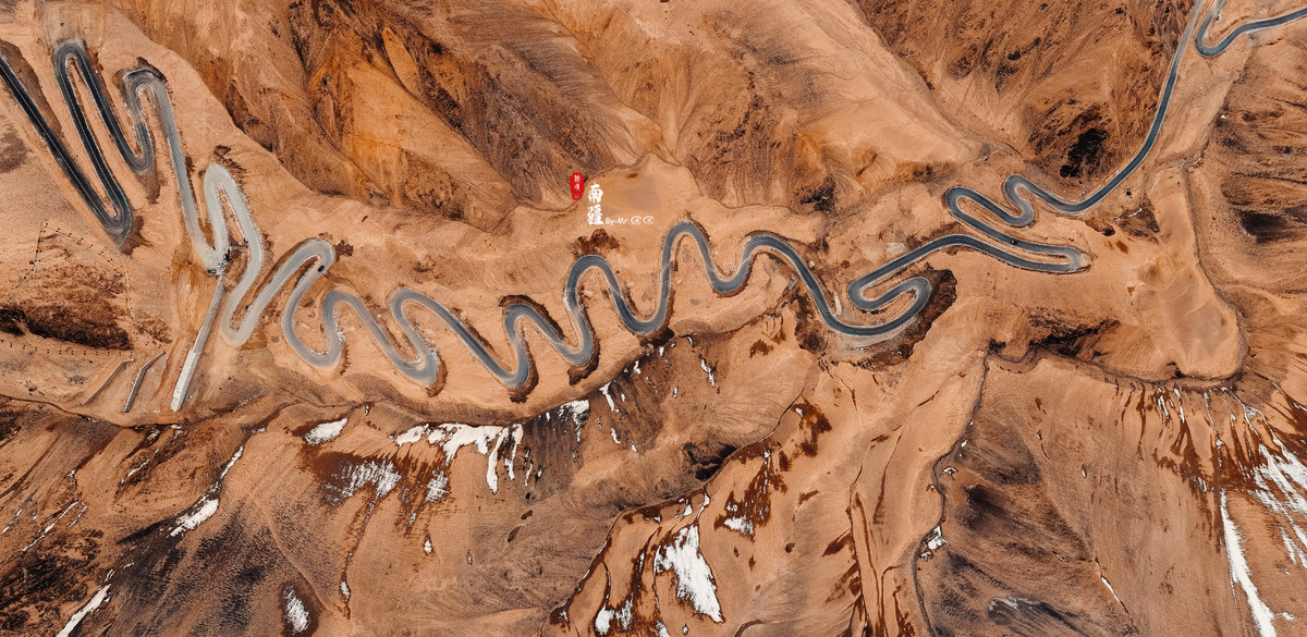
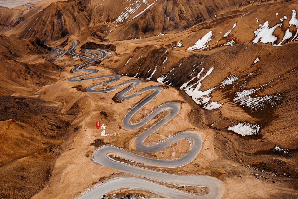
The Panlong Ancient Road was completed in 2019. It runs along the Kunlun Mountains, with an elevation increase from 3,000 meters to around 4,100 meters. The total length is over 70 kilometers. It is said to have more than 600 bends, and most of the bends are over 180 degrees, and some even exceed 270 degrees. The entire road is asphalt. From an aerial perspective, it looks like a giant dragon hovering over this frontier area. Whether it is the visual impact of the combination of yellow soil, black road, and snow-capped mountains, or the driving experience of the super winding road, all these are sufficient to give this road the title of "Must-Drive This Lifetime".
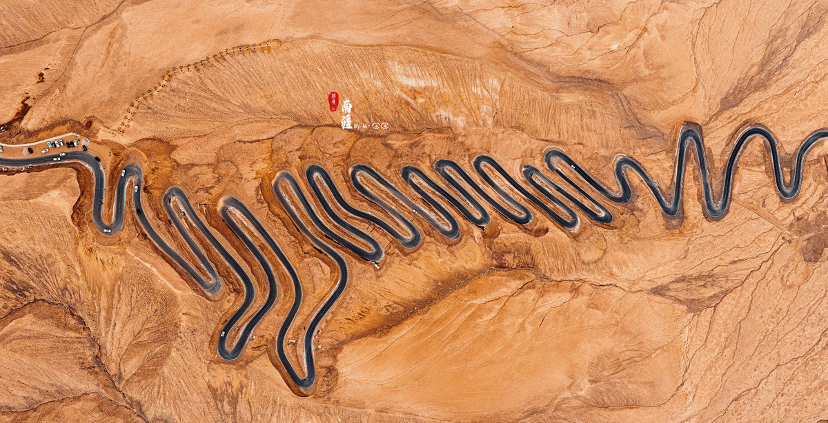
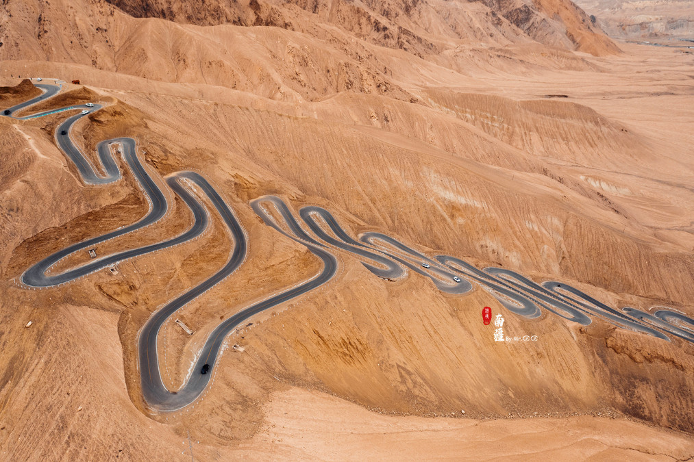
One after another, vehicles came here in an orderly manner to ascend and descend the mountain. From the perspective of driving on this ancient road, it's not particularly difficult to drive, but it does cause a lot of brake pad wear~. Every curve is very steep, and when turning, you basically need to apply the brakes and slowly make the turn. When going downhill, music from "Fast & Furious" is playing in the car, but there's no speed, only passion! The experience is quite good, but you still need to be careful and proceed with caution.

The viewpoints along the Panlong Ancient Road are divided into the Small Panlong and the Large Panlong. The Small Panlong is located at the bottom, which is more regular. The Large Panlong at the top appears more winding, with some curves showing an undulating pattern.


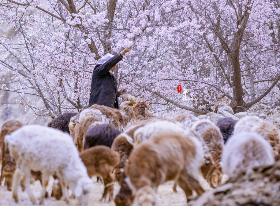
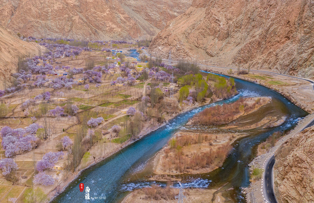
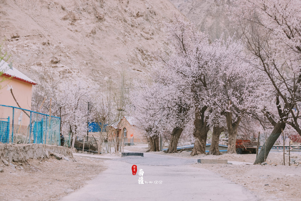
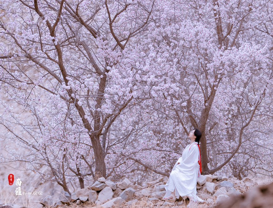
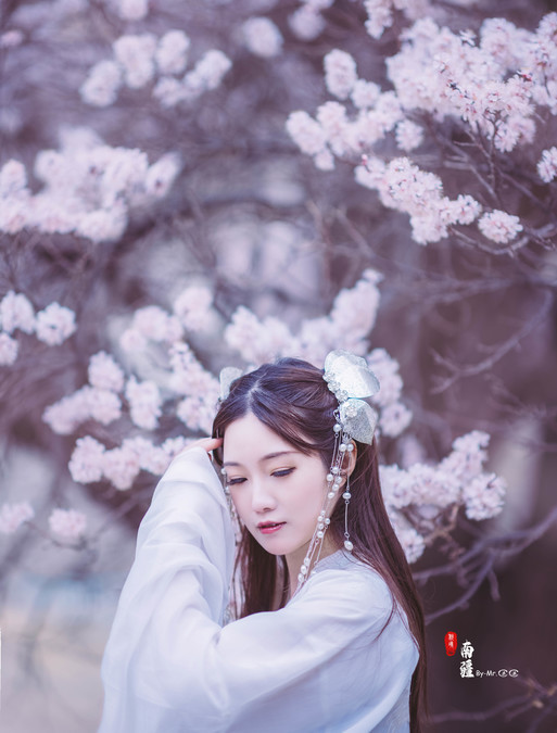
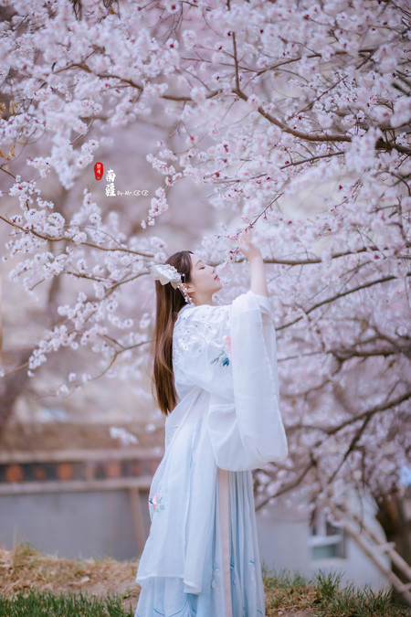
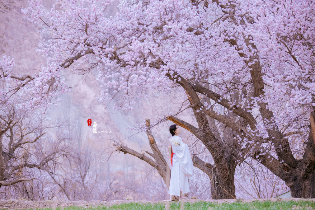
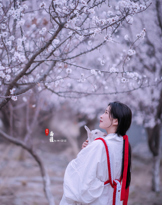
When the apricot blossoms are in full bloom
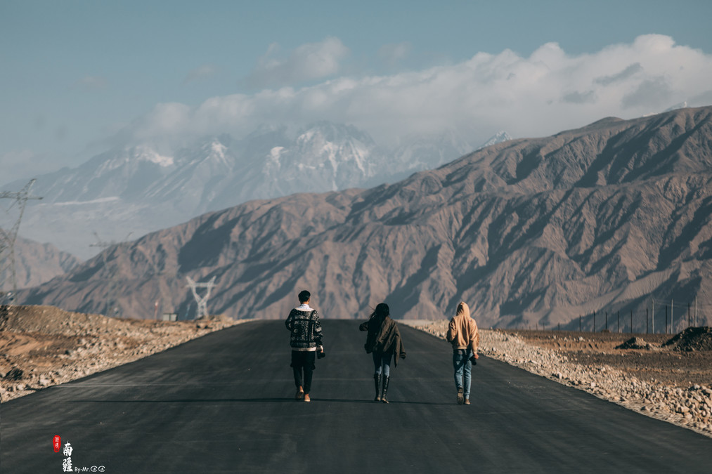
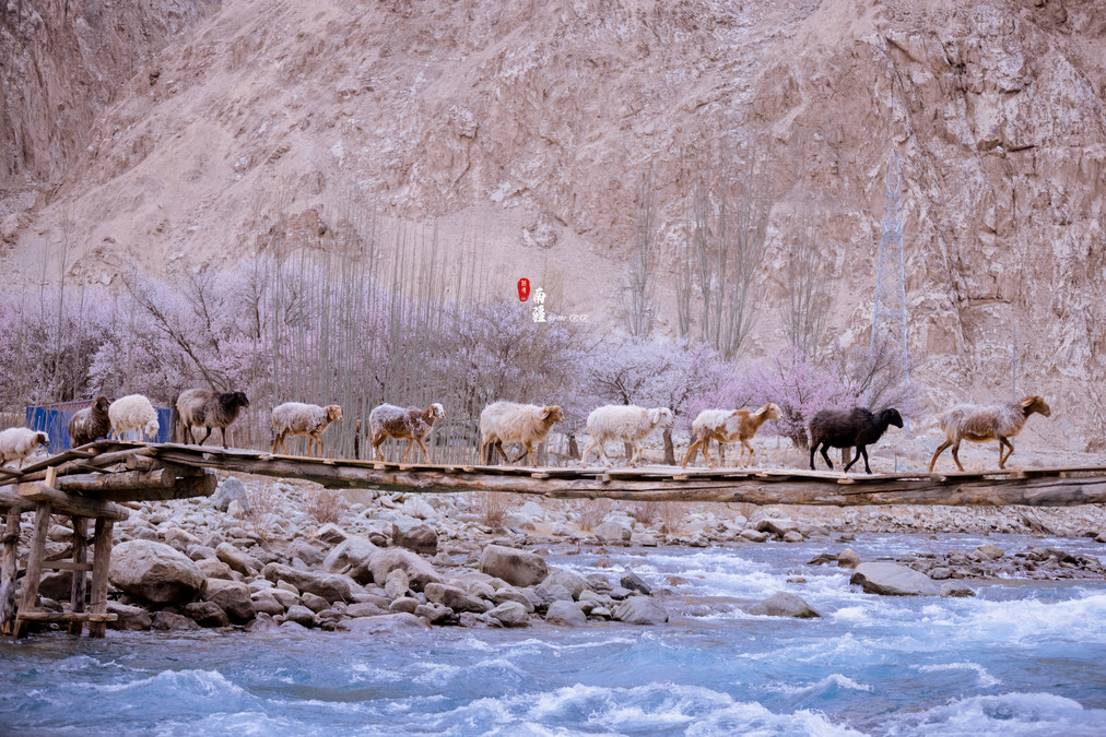
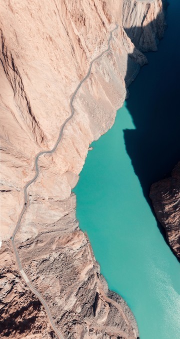
Return along the original route from Wacha Township, head east along the Tashkur River, and continue traveling through the canyon of the Pamir Plateau. Both sides are high cliffs. The important destination of our trip, Xinghua Village, is hidden in this valley. When entering the Kusirulug Township, you can see the blooming apricot flowers on the roadside. The "Apricot Village" we are talking about is located in Kusiruluk Township, Tar Township, and Datong Township. On the 100-kilometer road from Kusiruluk Township to Datong Township, there are large and small Tajik villages scattered along the way.
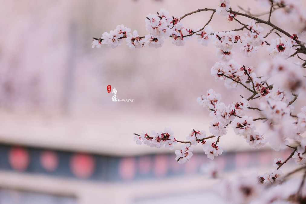
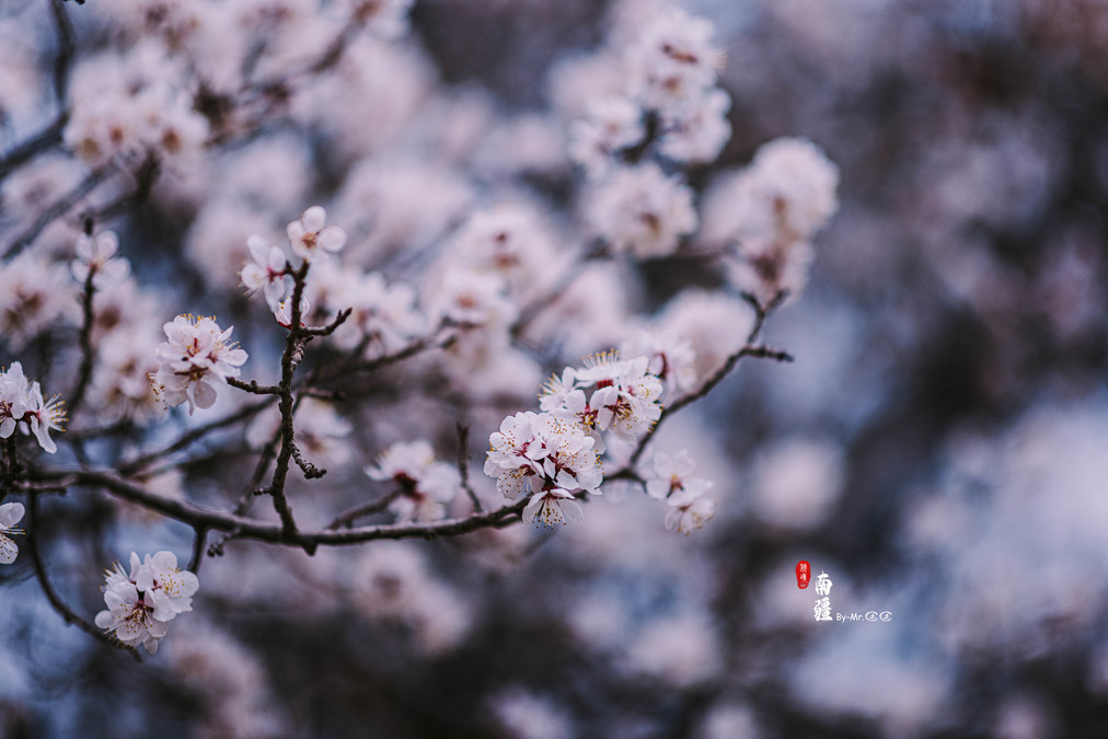
At the end of March every year, it is the time when the apricot flowers are in full bloom. The century-old apricot trees in the village start to compete to blossom. The entire tree is covered with apricot flowers, resembling a huge umbrella. Walking among the apricot flower groves and experiencing the life of the Tajik people beneath the apricot blossoms on this plateau, I think this must be the "paradise on earth".
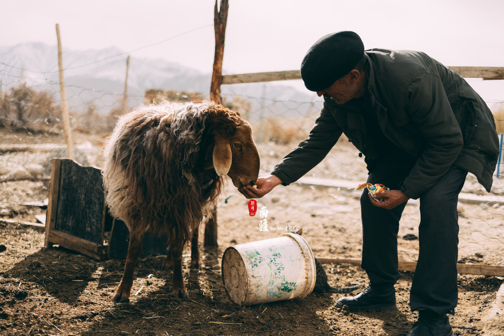
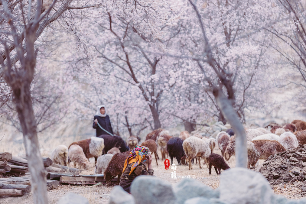
Under the apricot tree, the herdsman was grazing his sheep, looking kindly at the flock.

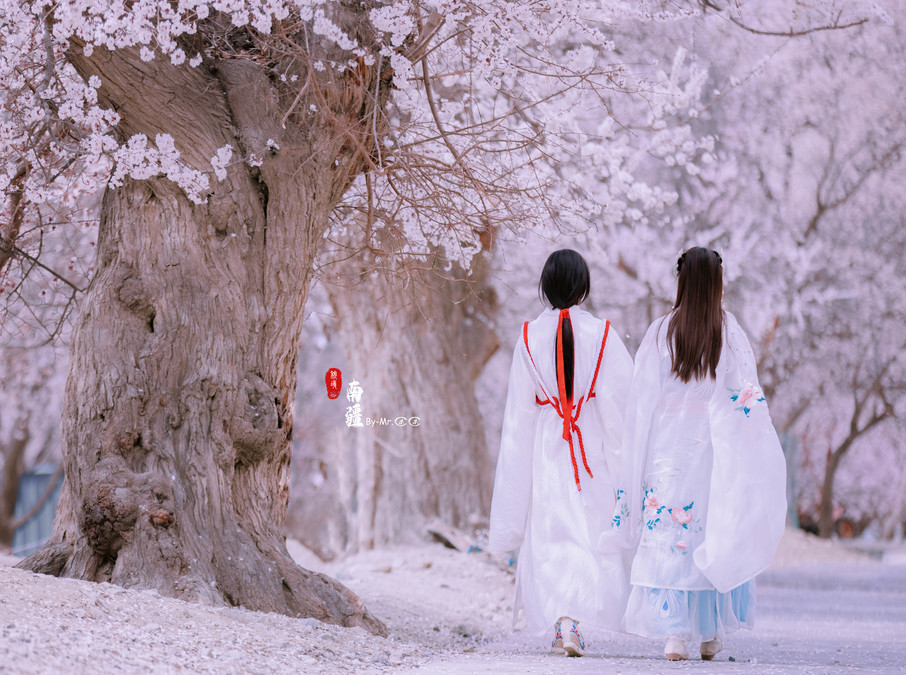
Jingjing and Qiqi put on clothes from different eras and, under the apricot tree, embarked on a journey through time and space.


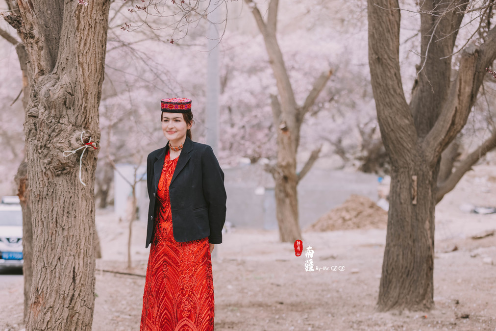
The beautiful and kind Tajik people


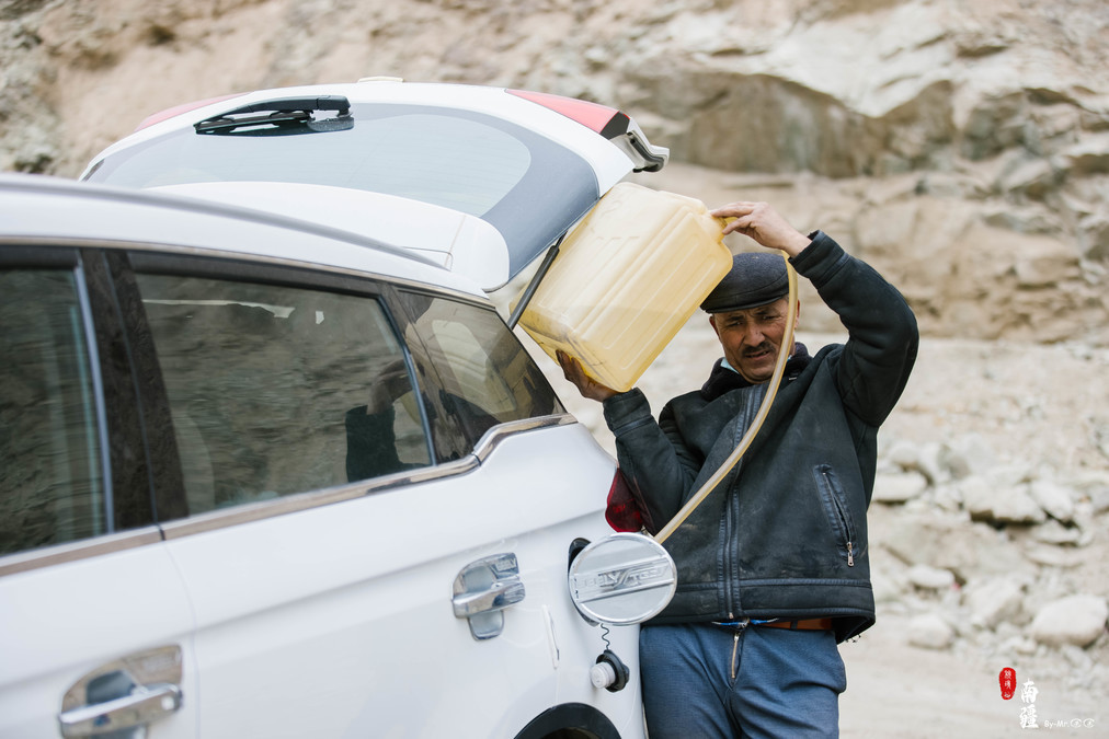
The accommodations along the way to Xinghua Village were mostly local residents' houses. The one we stayed in was similar to a large bunk bed. The accommodation conditions were relatively ordinary. It is recommended to have your bath before arriving in Taya County. Once you arrive in Xinghua Village, don't think about taking a bath. On the night we arrived, the entire town experienced a power outage, and the telecommunications signal also went down. Basically, we lived without power and internet for three days. Thinking about disconnecting from the outside world's hustle and bustle and truly experiencing this magical land is also quite nice~

Due to the power outage, the only gas station in the canyon was also unable to operate. The fuel supply was almost running out. The locals had been searching for a long time and finally found a place where they could manually refuel in a small corner.
Tashagudao - Xuanzang's Route
Tashguo Road is a road that leads from the Tashkurgan Tajik Autonomous County to Shehwa County. It is a small branch of the Silk Road.
In the year 628 AD, Master Xuanzang traveled alone along the ancient Silk Road to India to worship Buddha and collect Buddhist scriptures. The "Tang Dynasty Record of the Western Regions" records that when Master Xuanzang returned from his journey, he crossed the Tashagou Road. "He headed eastward to the eastern slopes of the Sonali Mountains, ascending perilous mountains and crossing cave valleys. The paths were perilous and the weather was stormy and snowy. He traveled over 800 miles and emerged from the Sonali Mountains in Ushen Kingdom" (The Sonali Mountains refer to the Pamir Plateau and Ushen Kingdom is the Shache County).
The Tashagudao has been renovated many times over the years. However, the section of road from Datong Township to Shache remains a one-way street. Before setting off, the local residents also warned us to be careful of falling rocks and to pass through quickly.

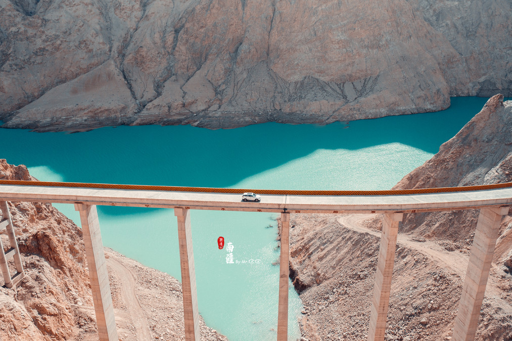
On one side is a steep cliff, and on the other is the peaceful Yarkand River.
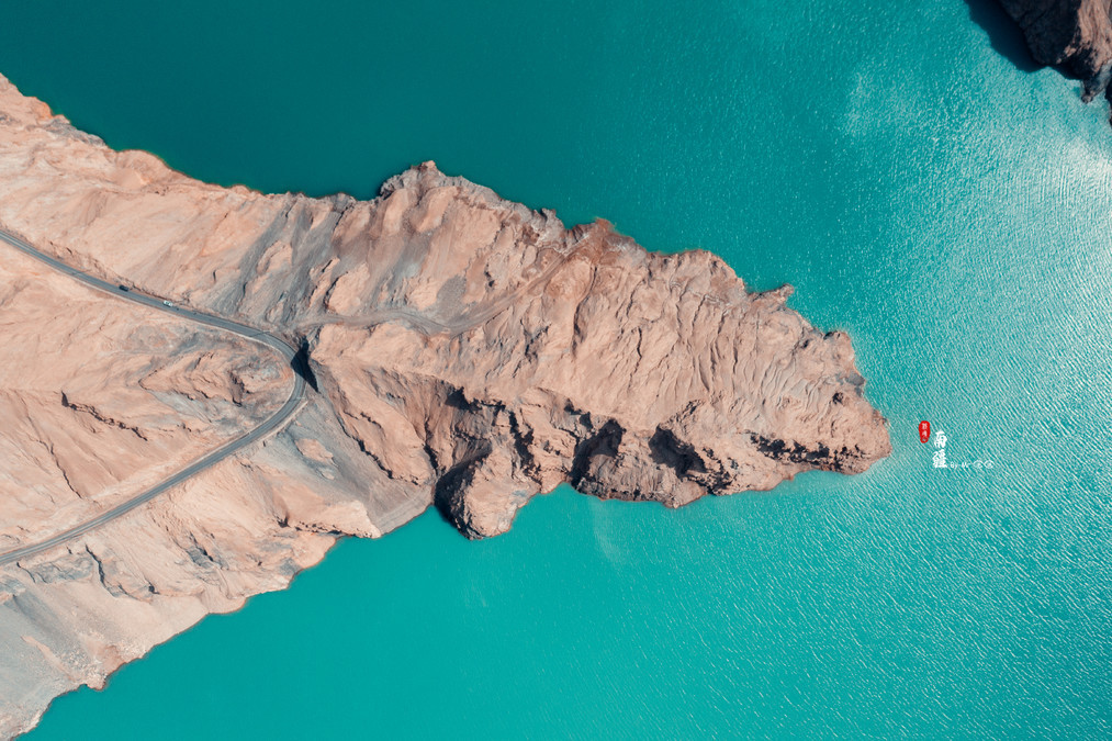
This bridge built on the cliff caught the attention of both me and Tony. From the bridge, we could see a path below. This must be the ancient road before the renovation. At first, I drove the car while Tony used a drone to shoot. After one round, we didn't feel satisfied. So we changed positions and he drove while I shot again~
As we walked along the huge mountain, the farther we went, the more desolate it became. There was not a single blade of grass to be seen. The steep mountains were craggy and strange. Gradually, it seemed as if the entire world was reduced to just our vehicle.
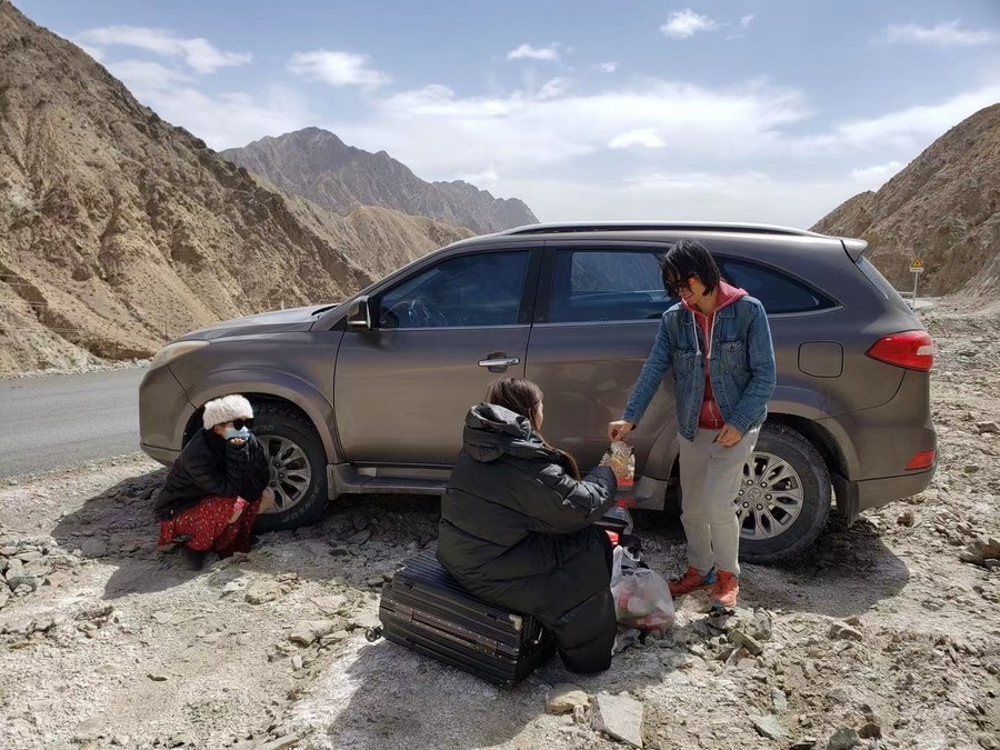
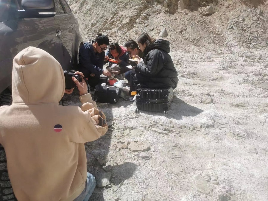
From the early morning, we had been circling along the perilous ancient road. After climbing over the cliffs and peaks, our stomachs rebelled and we found a relatively open area to have our instant hot pot meal.
In the face of this scene, Jingjing sat alone on the side, not knowing what was going on in her mind.
The final stretch of road is another winding mountain road. That ancient path from thousands of years ago has been buried at the bottom of the river to a large extent due to the construction of the reservoir. The roads we have driven along this entire journey are all newly paved asphalt roads. It's hard to imagine how much perseverance the Buddhist monk Xuanzang must have had to traverse this ancient path thousands of years ago.

The first thing to do upon returning to Kashgar is to have a good, relaxing bath, followed by a hearty meal. Thinking about all the rough traveling and sleeping outdoors we've endured these past few days, we must have lost a lot of weight!
Some final thoughts and shooting tips
【This Trip Schedule】
Day 1: Kashgar
Day 2: Kashgar --- Red Canyon --- Muji Volcano
Day 3: Muji Volcano --- Baisha Lake --- Taya County
Day 4: Taya County
Day 5: Taya County --- Wachacha Township --- Panlong Ancient Road --- Xinghua Village
Day 6: Xinghua Village
Day 7: Xinghua Village --- Tashag Road --- Kashgar
Actually, this trip was rather rushed. The southern Xinjiang region is a place that is suitable for a leisurely exploration. If time permits, it is recommended to reserve more days. Kashi is definitely worth spending more days to explore thoroughly. Taixian was missed due to the reason that the bus broke down and we had to change vehicles. Shiteng and Jincaotan were also missed. The little girl who helped us last time when we were in Xinjiang didn't go either. All of these are quite regrettable. Xiaohua Village should also have been given one more day to visit the residents' houses and experience it. These are all quite regrettable. However, with regrets comes motivation. I hope when I come to southern Xinjiang next time, I won't be influenced by time and will slow down to truly enjoy the place.
[About Driving]
The roads in Xinjiang are not difficult to drive, and they have been well maintained now. Most of them are asphalt roads throughout the route. However, it is still advisable to proceed with caution and avoid taking risks. Nowadays, renting cars through various platforms is also very convenient. If something goes wrong, you must take photos as evidence first. In this case, the front bumper was damaged on our trip. At first, everyone was inexperienced and forgot to take photos, which ultimately prevented us from claiming insurance. Experience must be learned from!!
【Some Simple Shooting Tips】
When shooting children in the ancient city of Kashgar, I had an 85mm lens with me. But when I got there, I felt a bit regretful. The humanistic shooting of children is different from that of adults. The children are too lively. When the fixed-focus lens chased after them, it was really painful. At that time, I secretly blamed myself for choosing the zoom lens because I wanted to be lighter~
The southern Xinjiang region is a place full of exotic charm. For girls, red or white dresses seem to always be versatile. You can also prepare one or two sets of ethnic costumes. Since it's the time when peach blossoms are in full bloom this year, the fellow girls traveling with us have also brought Hanfu along.
In the southern Xinjiang region, drones are also essential equipment. As long as they are not near the border or in some restricted flight zones, they can be flown in most areas. If this trip did not involve drones, the photos of the Muji Volcano, Panlong Ancient Road, and Tashag Ancient Road would be much less impressive.
【In the end...】
I don't know how reckless I was when I was young. The road lies beneath my feet, the ideal lies in the distance. The road is very difficult to traverse. I'm grateful for those who can accompany me on this journey together.